

Monthey-Genève par la côte française
A cycling route starting in Monthey, Valais, Switzerland.
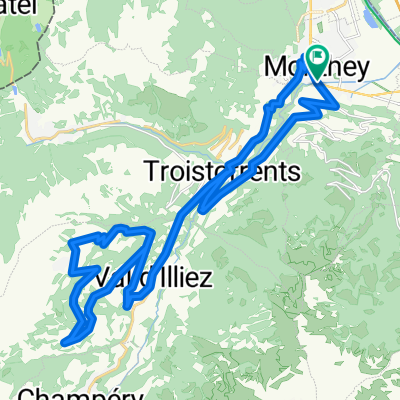
Overview
About this route
De Monthey à Genève, par la Route du Rhône (Suisse à vélo n°1), puis la côte lémanique française.
Piste cyclable sur la digue du Rhône en Valais, voie verte entre St-Gingolph et Locum, route nationale à fort trafic jusqu'à Amphion-les-Bains, puis zigzags pour éviter le trafic jusqu'à Sciez. Si vous êtes sauf à ce point, c'est gagné : le parcours est agréable jusqu'à Genève.
J'ai tenté cet itinéraire un dimanche, passant la frontière à St-Gingolph autour de midi, donc au meilleur moment pour bénéficier d'un trafic réduit. En l'absence d'aménagements cyclables entre Locum et Amphion, je déconseille ce parcours aux heures de fort trafic !
Espérons que les autorités savoyardes prolongeront la voie verte au-delà de Locum avant le 4e millénaire...
Distance : 100 km
Dénivelé positif : 350 m
Altitude maximale : 475 m (Loisin)
Plus d'informations sur www.europebybike.info
- -:--
- Duration
- 98.5 km
- Distance
- 283 m
- Ascent
- 318 m
- Descent
- ---
- Avg. speed
- 467 m
- Max. altitude

Route quality
Waytypes & surfaces along the route
Waytypes
Quiet road
30.6 km
(31 %)
Busy road
19.9 km
(20 %)
Surfaces
Paved
85.2 km
(86 %)
Unpaved
0.2 km
(<1 %)
Asphalt
83.3 km
(84 %)
Paved (undefined)
1.1 km
(1 %)
Route highlights
Points of interest along the route
Drinking water after 18.9 km
Fontaine
Drinking water after 56.1 km
Fontaine
Drinking water after 69.4 km
Fontaine
Drinking water after 84 km
Fontaine
Continue with Bikemap
Use, edit, or download this cycling route
You would like to ride Monthey-Genève par la côte française or customize it for your own trip? Here is what you can do with this Bikemap route:
Free features
- Save this route as favorite or in collections
- Copy & plan your own version of this route
- Split it into stages to create a multi-day tour
- Sync your route with Garmin or Wahoo
Premium features
Free trial for 3 days, or one-time payment. More about Bikemap Premium.
- Navigate this route on iOS & Android
- Export a GPX / KML file of this route
- Create your custom printout (try it for free)
- Download this route for offline navigation
Discover more Premium features.
Get Bikemap PremiumFrom our community
Other popular routes starting in Monthey
 Boucle Monthey-Bouveret
- Distance
- 45.6 km
- Ascent
- 278 m
- Descent
- 278 m
- Location
- Monthey, Valais, Switzerland
 Champoussin par la route de Meureunez
- Distance
- 36.7 km
- Ascent
- 1,201 m
- Descent
- 1,201 m
- Location
- Monthey, Valais, Switzerland
 Chablais d'Enfer Aulp-dessus
- Distance
- 244.4 km
- Ascent
- 5,048 m
- Descent
- 5,048 m
- Location
- Monthey, Valais, Switzerland
 Les Crosets
- Distance
- 20.5 km
- Ascent
- 1,276 m
- Descent
- 29 m
- Location
- Monthey, Valais, Switzerland
 Monthey Brigue
- Distance
- 104.8 km
- Ascent
- 453 m
- Descent
- 199 m
- Location
- Monthey, Valais, Switzerland
 My Tour
- Distance
- 28.6 km
- Ascent
- 76 m
- Descent
- 93 m
- Location
- Monthey, Valais, Switzerland
 La Vallée d Abondance
- Distance
- 94.3 km
- Ascent
- 1,206 m
- Descent
- 1,206 m
- Location
- Monthey, Valais, Switzerland
 PROJET VELO 2019
- Distance
- 1,363.2 km
- Ascent
- 1,475 m
- Descent
- 1,870 m
- Location
- Monthey, Valais, Switzerland
Open it in the app