Anacostia Trail
A cycling route starting in Bladensburg, Maryland, United States.
Overview
About this route
Route for 2008 Anacostia Trails Fall Foliage Bike Ride on October 25. Mostly on paved trails. Detour through Macgruder Park because of WSSC work across trail. Goes across University of Maryland campus.
- -:--
- Duration
- 26.7 km
- Distance
- 132 m
- Ascent
- 124 m
- Descent
- ---
- Avg. speed
- 58 m
- Max. altitude
Route quality
Waytypes & surfaces along the route
Waytypes
Cycleway
18.3 km
(69 %)
Pedestrian area
2.5 km
(9 %)
Surfaces
Paved
23.1 km
(87 %)
Unpaved
0.1 km
(<1 %)
Asphalt
22 km
(83 %)
Concrete
0.9 km
(3 %)
Continue with Bikemap
Use, edit, or download this cycling route
You would like to ride Anacostia Trail or customize it for your own trip? Here is what you can do with this Bikemap route:
Free features
- Save this route as favorite or in collections
- Copy & plan your own version of this route
- Sync your route with Garmin or Wahoo
Premium features
Free trial for 3 days, or one-time payment. More about Bikemap Premium.
- Navigate this route on iOS & Android
- Export a GPX / KML file of this route
- Create your custom printout (try it for free)
- Download this route for offline navigation
Discover more Premium features.
Get Bikemap PremiumFrom our community
Other popular routes starting in Bladensburg
- College Park to National Park
- Distance
- 54.5 km
- Ascent
- 158 m
- Descent
- 152 m
- Location
- Bladensburg, Maryland, United States
- 11/11/2012 Maryland trek
- Distance
- 29.5 km
- Ascent
- 121 m
- Descent
- 122 m
- Location
- Bladensburg, Maryland, United States
- Easy ride in College Park
- Distance
- 6.5 km
- Ascent
- 0 m
- Descent
- 3 m
- Location
- Bladensburg, Maryland, United States
- Annapolis Road 4601, Bladensburg to Annapolis Road 4601, Bladensburg
- Distance
- 26.8 km
- Ascent
- 99 m
- Descent
- 69 m
- Location
- Bladensburg, Maryland, United States
- Bladensburg to Fairland Regional Park
- Distance
- 47.4 km
- Ascent
- 353 m
- Descent
- 341 m
- Location
- Bladensburg, Maryland, United States
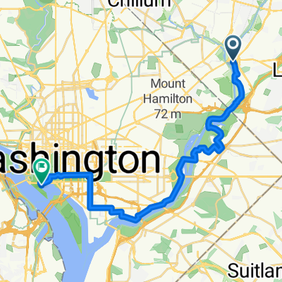
- Bladensburg to College Park
- Distance
- 27 km
- Ascent
- 126 m
- Descent
- 136 m
- Location
- Bladensburg, Maryland, United States
- Annapolis Road 4601, Bladensburg to Annapolis Road 4601, Bladensburg
- Distance
- 48.7 km
- Ascent
- 272 m
- Descent
- 242 m
- Location
- Bladensburg, Maryland, United States
- Bladensburg to Nationals ball park
- Distance
- 27.5 km
- Ascent
- 119 m
- Descent
- 100 m
- Location
- Bladensburg, Maryland, United States
Open it in the app