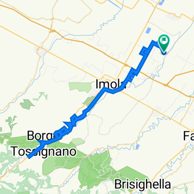
Ciclovia del Santerno Da Via Ponte 2, Mordano a Via Ponte Alidosi 1, Castel del Rio
- 57.1 km
- 1,263 m
- 1,062 m
- Mordano, Emilia-Romagna, Italy
A cycling route starting in Mordano, Emilia-Romagna, Italy.
Overview
Percorso di recente realizzazione (2021) inserito nel corridoio idrografico del fiume Santerno. L'itinerario è continuo, ma presenta caratteristiche di ambiente e ciclabilità molto diverse per il mutare del territorio. Nella parte più bassa è un classico percorso arginale sul fiume pensile, si entra poi nel tessuto urbano della città di Imola lambendo uno dei templi degli sport motoristici ovvero l'autodromo Dino Ferrari. Si imbocca successivamente la traccia del canale dei molini prima pedalando sopra lo stesso canale chiuso e poi a lato fino alla diga/presa di Codrignano. Ora siamo di nuovo sul fiume per arrivare all'area dei gessi poco dopo l'abitato di Borgo Tossignano. Siamo letteralmente sul fiume perchè lo si attraversa su tre guadi "armati" con pietre Intervallate da uno spazio di 30 cm per consentire il deflusso dell'acqua e che consentono il passaggio all'asciutto con bici alla mano. Arriviamo così a Fontanelice e il contesto cambia ancora facendosi però più arduo per le salite e per qualche passaggio sulla trafficata via Montanara per giungere a Castel del Rio transitando sopra il bellissimo Ponte degli Alidosi. Quest'ultimo tratto è dunque impegnativo ed è consigliato solo a ciclisti esperti e allenati e con biciclette con ruote di sezione adeguate come MTB o Gravel.
Recently built route (2021) inserted in the fluvial corridor of the Santerno river. The itinerary is continuous, but has very different characteristics of environment and cycling due to the changing territory. In the lower part it is a classic embankment path on the hanging river, then you enter the urban area of the city of Imola, skirting one of the temples of motor sports or the Dino Ferrari autodrome. Then take the track of the canal of the mills, first pedaling over the same closed canal and then to the side up to the dam / rising of Codrignano. Now we are back on the river to arrive at the Gypsum Park shortly after the village of Borgo Tossignano. We are literally on the river because you cross it on three fords "armed" with stones spaced by clearance of 30 cm to allow the water to flow out and which allow the passage safe and dry with bikes in hand. We thus arrive in Fontanelice and the context changes again, however becoming more difficult because of the steep climb and for some passage on the busy Via Montanara to reach Castel del Rio passing over the beautiful Ponte degli Alidosi. This last stretch is therefore challenging and is only recommended to experienced and trained cyclists and bicycles with large section pneus such as MTB or Gravel.
created this 4 years ago
 03 BO Ciclovia del Santerno da Mordano a Castel del Rio\"")
 03 BO Ciclovia del Santerno da Mordano a Castel del Rio\"")
 03 BO Ciclovia del Santerno da Mordano a Castel del Rio\"")
 03 BO Ciclovia del Santerno da Mordano a Castel del Rio\"")
 03 BO Ciclovia del Santerno da Mordano a Castel del Rio\"")
 03 BO Ciclovia del Santerno da Mordano a Castel del Rio\"")
 03 BO Ciclovia del Santerno da Mordano a Castel del Rio\"")
Route quality
Cycleway
23.1 km
52 %
Quiet road
11.1 km
25 %
Paved
19.1 km
(43 %)
Unpaved
15.6 km
(35 %)
Asphalt
17.8 km
40 %
Gravel
15.1 km
34 %
Continue with Bikemap
You would like to ride e) 03 BO Ciclovia del Santerno da Mordano a Castel del Rio or customize it for your own trip? Here is what you can do with this Bikemap route:
Free trial for 3 days, or one-time payment. More about Bikemap Premium.
Discover more Premium features.
Get Bikemap PremiumFrom our community
Open it in the app