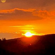
Massa-Prata-Meleta-Roccastrada-Montemassi-Ribolla-Perolla-Massa
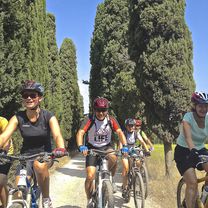
A cycling route starting in Massa Marittima, Tuscany, Italy.
Overview
About this route
Beautiful tour on lightly traveled roads with mostly good pavement
- -:--
- Duration
- 77.9 km
- Distance
- 1,412 m
- Ascent
- 1,411 m
- Descent
- ---
- Avg. speed
- 592 m
- Max. altitude
Route quality
Waytypes & surfaces along the route
Waytypes
Road
7 km
(9 %)
Quiet road
0.8 km
(1 %)
Undefined
70.1 km
(90 %)
Surfaces
Paved
35.8 km
(46 %)
Asphalt
35.8 km
(46 %)
Undefined
42.1 km
(54 %)
Continue with Bikemap
Use, edit, or download this cycling route
You would like to ride Massa-Prata-Meleta-Roccastrada-Montemassi-Ribolla-Perolla-Massa or customize it for your own trip? Here is what you can do with this Bikemap route:
Free features
- Save this route as favorite or in collections
- Copy & plan your own version of this route
- Sync your route with Garmin or Wahoo
Premium features
Free trial for 3 days, or one-time payment. More about Bikemap Premium.
- Navigate this route on iOS & Android
- Export a GPX / KML file of this route
- Create your custom printout (try it for free)
- Download this route for offline navigation
Discover more Premium features.
Get Bikemap PremiumFrom our community
Other popular routes starting in Massa Marittima
Bibbona - Massa Marittima- Distance
- 46.5 km
- Ascent
- 358 m
- Descent
- 722 m
- Location
- Massa Marittima, Tuscany, Italy
4 - MTB - Cross Country - Gavorrano - Green -- Distance
- 27.2 km
- Ascent
- 420 m
- Descent
- 420 m
- Location
- Massa Marittima, Tuscany, Italy
7 - MTB - Cross Country - Green/Blue - Tour Massa Marittima- Distance
- 25.7 km
- Ascent
- 339 m
- Descent
- 338 m
- Location
- Massa Marittima, Tuscany, Italy
toscana- Distance
- 31.5 km
- Ascent
- 362 m
- Descent
- 359 m
- Location
- Massa Marittima, Tuscany, Italy
MTB 14 km La Pesta Singletrails- Distance
- 14.7 km
- Ascent
- 352 m
- Descent
- 352 m
- Location
- Massa Marittima, Tuscany, Italy
5 - MTB - Cross Country - Tour Gavorrano - Blue -- Distance
- 33.1 km
- Ascent
- 497 m
- Descent
- 497 m
- Location
- Massa Marittima, Tuscany, Italy
8 - MTB - Cross Country - Blue - Tour Massa Marittima- Distance
- 31.4 km
- Ascent
- 513 m
- Descent
- 502 m
- Location
- Massa Marittima, Tuscany, Italy
Massa Marittima Maggio to Via Sant'Agata- Distance
- 67.3 km
- Ascent
- 1,933 m
- Descent
- 2,117 m
- Location
- Massa Marittima, Tuscany, Italy
Open it in the app


