236–298 Paulsen Ln, Palo Alto to 800 Russet Dr, Sunnyvale
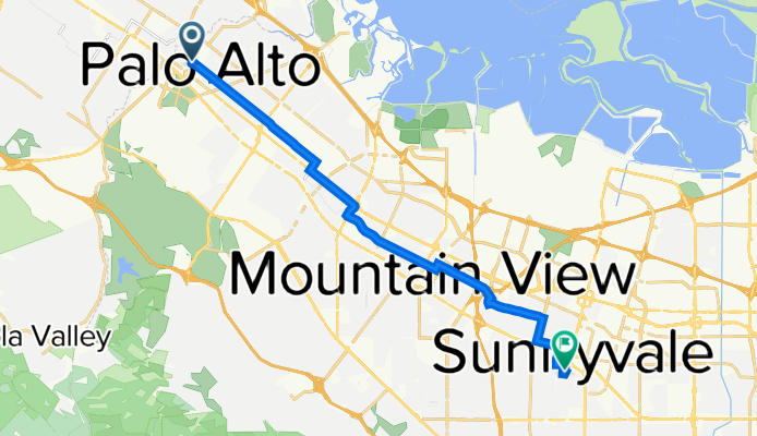
A cycling route starting in Palo Alto, California, United States of America.
Overview
About this route
- 56 min
- Duration
- 16.5 km
- Distance
- 39 m
- Ascent
- 15 m
- Descent
- 17.7 km/h
- Avg. speed
- 44 m
- Avg. speed
Route quality
Waytypes & surfaces along the route
Waytypes
Quiet road
8.5 km
(52 %)
Busy road
4.2 km
(25 %)
Surfaces
Paved
13.6 km
(82 %)
Asphalt
12.9 km
(78 %)
Concrete
0.6 km
(4 %)
Undefined
2.9 km
(18 %)
Continue with Bikemap
Use, edit, or download this cycling route
You would like to ride 236–298 Paulsen Ln, Palo Alto to 800 Russet Dr, Sunnyvale or customize it for your own trip? Here is what you can do with this Bikemap route:
Free features
- Save this route as favorite or in collections
- Copy & plan your own version of this route
- Sync your route with Garmin or Wahoo
Premium features
Free trial for 3 days, or one-time payment. More about Bikemap Premium.
- Navigate this route on iOS & Android
- Export a GPX / KML file of this route
- Create your custom printout (try it for free)
- Download this route for offline navigation
Discover more Premium features.
Get Bikemap PremiumFrom our community
Other popular routes starting in Palo Alto
- 236–298 Paulsen Ln, Palo Alto to 800 Russet Dr, Sunnyvale
- Distance
- 16.5 km
- Ascent
- 39 m
- Descent
- 15 m
- Location
- Palo Alto, California, United States of America
- Slow ride in Palo Alto
- Distance
- 12.2 km
- Ascent
- 12 m
- Descent
- 12 m
- Location
- Palo Alto, California, United States of America
- Moderate route in Palo Alto
- Distance
- 22.7 km
- Ascent
- 82 m
- Descent
- 74 m
- Location
- Palo Alto, California, United States of America
- Portola and Altamont
- Distance
- 43.5 km
- Ascent
- 560 m
- Descent
- 553 m
- Location
- Palo Alto, California, United States of America
- Mollie to near 101
- Distance
- 4.8 km
- Ascent
- 4 m
- Descent
- 4 m
- Location
- Palo Alto, California, United States of America
- PA -> SRWC
- Distance
- 11.4 km
- Ascent
- 12 m
- Descent
- 17 m
- Location
- Palo Alto, California, United States of America
- Portola + Canada Loop
- Distance
- 59.6 km
- Ascent
- 444 m
- Descent
- 444 m
- Location
- Palo Alto, California, United States of America
- Page Mill, La Honda, Alpine
- Distance
- 65.9 km
- Ascent
- 1,306 m
- Descent
- 1,304 m
- Location
- Palo Alto, California, United States of America
Open it in the app