

ETT 2022 Gesamte Strecke
A cycling route starting in Tübingen, Baden-Wurttemberg, Germany.
Overview
About this route
Tübingen, Neuhausen an der Erms, Donau, Altmühl, Main-Donau-Kanal, Regnitz, Main, Tauber, Neckar, Tübingen
Stand 28.08.21
,
,
,
19.08.21
,
Fertig bis Km 97
- -:--
- Duration
- 877.3 km
- Distance
- 6,381 m
- Ascent
- 6,375 m
- Descent
- ---
- Avg. speed
- 854 m
- Max. altitude

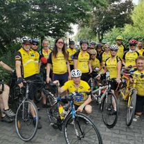
Route photos

Route quality
Waytypes & surfaces along the route
Waytypes
Road
210.6 km
(24 %)
Quiet road
157.9 km
(18 %)
Surfaces
Paved
710.6 km
(81 %)
Unpaved
26.3 km
(3 %)
Asphalt
684.3 km
(78 %)
Paved (undefined)
17.5 km
(2 %)
Continue with Bikemap
Use, edit, or download this cycling route
You would like to ride ETT 2022 Gesamte Strecke or customize it for your own trip? Here is what you can do with this Bikemap route:
Free features
- Save this route as favorite or in collections
- Copy & plan your own version of this route
- Split it into stages to create a multi-day tour
- Sync your route with Garmin or Wahoo
Premium features
Free trial for 3 days, or one-time payment. More about Bikemap Premium.
- Navigate this route on iOS & Android
- Export a GPX / KML file of this route
- Create your custom printout (try it for free)
- Download this route for offline navigation
Discover more Premium features.
Get Bikemap PremiumFrom our community
Other popular routes starting in Tübingen
 T Ruine Mundeck und mehr
- Distance
- 47.9 km
- Ascent
- 589 m
- Descent
- 598 m
- Location
- Tübingen, Baden-Wurttemberg, Germany
 kleine Bebenhäuser Runde...
- Distance
- 18.6 km
- Ascent
- 275 m
- Descent
- 201 m
- Location
- Tübingen, Baden-Wurttemberg, Germany
 Feierabendrunde ab Lustnau Tübingen
- Distance
- 34.3 km
- Ascent
- 149 m
- Descent
- 149 m
- Location
- Tübingen, Baden-Wurttemberg, Germany
 Tübingen - Schadensweiler Hof - Tübingen
- Distance
- 36.1 km
- Ascent
- 235 m
- Descent
- 235 m
- Location
- Tübingen, Baden-Wurttemberg, Germany
 ETT 2022 Gesamte Strecke
- Distance
- 877.3 km
- Ascent
- 6,381 m
- Descent
- 6,375 m
- Location
- Tübingen, Baden-Wurttemberg, Germany
 2017-02-01-H-Hirsch-Vitalia-A
- Distance
- 8.3 km
- Ascent
- 136 m
- Descent
- 138 m
- Location
- Tübingen, Baden-Wurttemberg, Germany
 Tübingen-Holzgerlingen-Altdorf-Herrenberg-Tübingen
- Distance
- 54.5 km
- Ascent
- 457 m
- Descent
- 420 m
- Location
- Tübingen, Baden-Wurttemberg, Germany
 French Quarter to Baggersee
- Distance
- 8.7 km
- Ascent
- 0 m
- Descent
- 0 m
- Location
- Tübingen, Baden-Wurttemberg, Germany
Open it in the app