

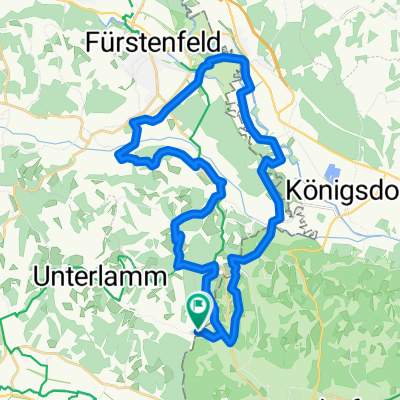
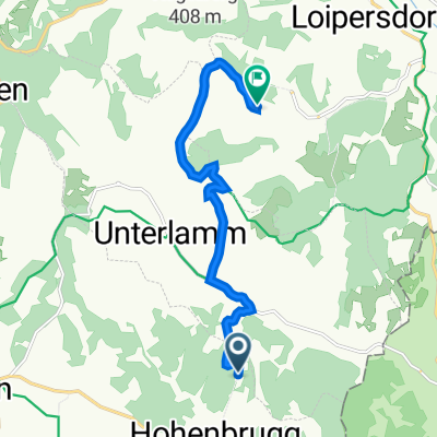
Unterlamm 122 nach Ober-Henndorf 27, Jennersdorf
A cycling route starting in Unterlamm, Styria, Austria.
Overview
About this route
- 4 h 12 min
- Duration
- 43.5 km
- Distance
- 802 m
- Ascent
- 754 m
- Descent
- 10.4 km/h
- Avg. speed
- ---
- Max. altitude

Route photos


Route quality
Waytypes & surfaces along the route
Waytypes
Quiet road
31.8 km
(73 %)
Road
3 km
(7 %)
Surfaces
Paved
40.9 km
(94 %)
Unpaved
2.2 km
(5 %)
Asphalt
40.9 km
(94 %)
Gravel
1.7 km
(4 %)
Continue with Bikemap
Use, edit, or download this cycling route
You would like to ride Unterlamm 122 nach Ober-Henndorf 27, Jennersdorf or customize it for your own trip? Here is what you can do with this Bikemap route:
Free features
- Save this route as favorite or in collections
- Copy & plan your own version of this route
- Sync your route with Garmin or Wahoo
Premium features
Free trial for 3 days, or one-time payment. More about Bikemap Premium.
- Navigate this route on iOS & Android
- Export a GPX / KML file of this route
- Create your custom printout (try it for free)
- Download this route for offline navigation
Discover more Premium features.
Get Bikemap PremiumFrom our community
Other popular routes starting in Unterlamm
 Unterlamm 33, Unterlamm nach Scheiberbuchweg, Unterlamm
- Distance
- 0.4 km
- Ascent
- 3 m
- Descent
- 4 m
- Location
- Unterlamm, Styria, Austria
 Mühlentour
- Distance
- 35.5 km
- Ascent
- 489 m
- Descent
- 490 m
- Location
- Unterlamm, Styria, Austria
 Greiterweg, Fehring nach Stein 6, Bad Loipersdorf
- Distance
- 8.5 km
- Ascent
- 174 m
- Descent
- 133 m
- Location
- Unterlamm, Styria, Austria
 Stoagupfrunde
- Distance
- 14.9 km
- Ascent
- 284 m
- Descent
- 286 m
- Location
- Unterlamm, Styria, Austria
 Lufttour 1
- Distance
- 68.7 km
- Ascent
- 655 m
- Descent
- 685 m
- Location
- Unterlamm, Styria, Austria
 2013.08.04 Omiš 3 Magland - Spielfield Eurovelo 9
- Distance
- 94.4 km
- Ascent
- 480 m
- Descent
- 376 m
- Location
- Unterlamm, Styria, Austria
 Unterlamm 122 nach Ober-Henndorf 27, Jennersdorf
- Distance
- 43.5 km
- Ascent
- 802 m
- Descent
- 754 m
- Location
- Unterlamm, Styria, Austria
 Magland Loipersdorf
- Distance
- 4.1 km
- Ascent
- 116 m
- Descent
- 51 m
- Location
- Unterlamm, Styria, Austria
Open it in the app