

Branston - Woodhall
A cycling route starting in Heighington, England, United Kingdom.
Overview
About this route
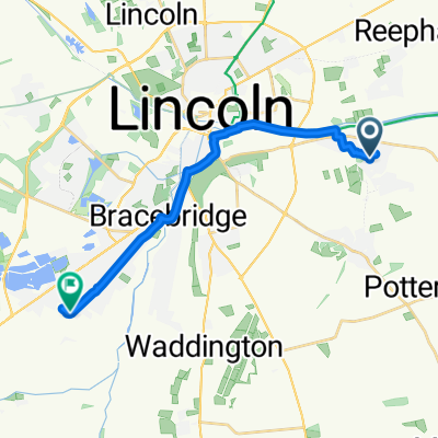
Branston to Woodhall via Five Mile Bridge
- -:--
- Duration
- 46.2 km
- Distance
- 20 m
- Ascent
- 61 m
- Descent
- ---
- Avg. speed
- 43 m
- Max. altitude
Route quality
Waytypes & surfaces along the route
Waytypes
Cycleway
21.2 km
(46 %)
Road
8.8 km
(19 %)
Surfaces
Paved
38.8 km
(84 %)
Unpaved
2.3 km
(5 %)
Asphalt
38.3 km
(83 %)
Gravel
1.4 km
(3 %)
Continue with Bikemap
Use, edit, or download this cycling route
You would like to ride Branston - Woodhall or customize it for your own trip? Here is what you can do with this Bikemap route:
Free features
- Save this route as favorite or in collections
- Copy & plan your own version of this route
- Sync your route with Garmin or Wahoo
Premium features
Free trial for 3 days, or one-time payment. More about Bikemap Premium.
- Navigate this route on iOS & Android
- Export a GPX / KML file of this route
- Create your custom printout (try it for free)
- Download this route for offline navigation
Discover more Premium features.
Get Bikemap PremiumFrom our community
Other popular routes starting in Heighington
 Branston - Woodhall
- Distance
- 46.2 km
- Ascent
- 20 m
- Descent
- 61 m
- Location
- Heighington, England, United Kingdom
 Brinkle Spring Lane, Lincoln to Ferry Lane, Boston
- Distance
- 39.3 km
- Ascent
- 0 m
- Descent
- 9 m
- Location
- Heighington, England, United Kingdom
 Branston to Sincil Street
- Distance
- 8.7 km
- Ascent
- 20 m
- Descent
- 53 m
- Location
- Heighington, England, United Kingdom
 39 Sleaford Road, Lincoln to 24 Sleaford Road, Lincoln
- Distance
- 14 km
- Ascent
- 19 m
- Descent
- 60 m
- Location
- Heighington, England, United Kingdom
 Oak Hill, Washingborough to Tanya Knitwear Factory
- Distance
- 7.2 km
- Ascent
- 32 m
- Descent
- 33 m
- Location
- Heighington, England, United Kingdom
 Gail Grove to Mill Lane
- Distance
- 14.6 km
- Ascent
- 138 m
- Descent
- 203 m
- Location
- Heighington, England, United Kingdom
 Cambridge Drive 6, Washingborough to Ferry Road
- Distance
- 15.6 km
- Ascent
- 1 m
- Descent
- 14 m
- Location
- Heighington, England, United Kingdom
 39 Sleaford Road, Lincoln to The Wesleyan Chapel, Fosse Lane, Lincoln
- Distance
- 18.2 km
- Ascent
- 70 m
- Descent
- 80 m
- Location
- Heighington, England, United Kingdom
Open it in the app