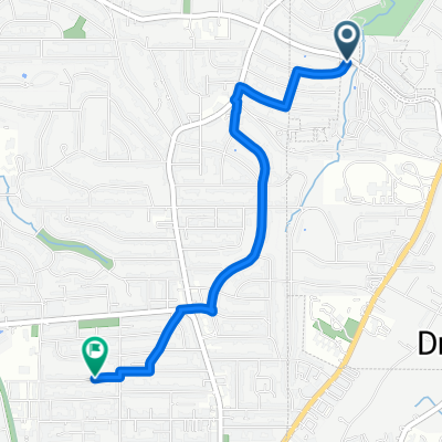
SCaRP 211002 Ride
A cycling route starting in Druid Hills, Georgia, United States of America.
Overview
About this route
20 km loop starting at the BeltLine 10th/Monroe entrance, going south on the BeltLine, east on the Stone Mountain Path, looping through Decatur, northwest to and through Emory University and returning to the start via Druid Hills and Virginia Highland.
- -:--
- Duration
- 23.2 km
- Distance
- 202 m
- Ascent
- 201 m
- Descent
- ---
- Avg. speed
- 329 m
- Avg. speed
Route quality
Waytypes & surfaces along the route
Waytypes
Cycleway
8.4 km
(36 %)
Quiet road
8.1 km
(35 %)
Surfaces
Paved
11.3 km
(49 %)
Paved (undefined)
5.6 km
(24 %)
Asphalt
3.2 km
(14 %)
Continue with Bikemap
Use, edit, or download this cycling route
You would like to ride SCaRP 211002 Ride or customize it for your own trip? Here is what you can do with this Bikemap route:
Free features
- Save this route as favorite or in collections
- Copy & plan your own version of this route
- Sync your route with Garmin or Wahoo
Premium features
Free trial for 3 days, or one-time payment. More about Bikemap Premium.
- Navigate this route on iOS & Android
- Export a GPX / KML file of this route
- Create your custom printout (try it for free)
- Download this route for offline navigation
Discover more Premium features.
Get Bikemap PremiumFrom our community
Other popular routes starting in Druid Hills
- Around House
- Distance
- 22.3 km
- Ascent
- 296 m
- Descent
- 266 m
- Location
- Druid Hills, Georgia, United States of America
- Atlanta Beltline [interim]
- Distance
- 44.1 km
- Ascent
- 457 m
- Descent
- 453 m
- Location
- Druid Hills, Georgia, United States of America
- SCaRP 211002 Ride
- Distance
- 23.2 km
- Ascent
- 202 m
- Descent
- 201 m
- Location
- Druid Hills, Georgia, United States of America
- Atlanta Beltline
- Distance
- 42.9 km
- Ascent
- 511 m
- Descent
- 512 m
- Location
- Druid Hills, Georgia, United States of America
- Clifton -> Lullwater
- Distance
- 11.2 km
- Ascent
- 115 m
- Descent
- 115 m
- Location
- Druid Hills, Georgia, United States of America
- Ramble walking route 2023
- Distance
- 2.5 km
- Ascent
- 34 m
- Descent
- 38 m
- Location
- Druid Hills, Georgia, United States of America
- Piedmont Avenue Northeast 1084, Atlanta to Hollingsworth Boulevard 1761, Atlanta
- Distance
- 11.3 km
- Ascent
- 116 m
- Descent
- 104 m
- Location
- Druid Hills, Georgia, United States of America
- Work vis CB
- Distance
- 6.1 km
- Ascent
- 87 m
- Descent
- 74 m
- Location
- Druid Hills, Georgia, United States of America