

pdc-1-v2
A cycling route starting in Ansty, England, United Kingdom.
Overview
About this route
first effort with this software...not yet impressed!
- -:--
- Duration
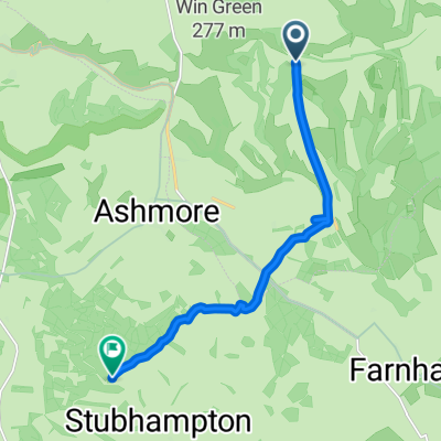
- 51 km
- Distance
- 397 m
- Ascent
- 395 m
- Descent
- ---
- Avg. speed
- 266 m
- Max. altitude

Continue with Bikemap
Use, edit, or download this cycling route
You would like to ride pdc-1-v2 or customize it for your own trip? Here is what you can do with this Bikemap route:
Free features
- Save this route as favorite or in collections
- Copy & plan your own version of this route
- Sync your route with Garmin or Wahoo
Premium features
Free trial for 3 days, or one-time payment. More about Bikemap Premium.
- Navigate this route on iOS & Android
- Export a GPX / KML file of this route
- Create your custom printout (try it for free)
- Download this route for offline navigation
Discover more Premium features.
Get Bikemap PremiumFrom our community
Other popular routes starting in Ansty
 WWR-Tollard Royal Link
- Distance
- 9.2 km
- Ascent
- 109 m
- Descent
- 235 m
- Location
- Ansty, England, United Kingdom
 swing
swing- Distance
- 0.4 km
- Ascent
- 9 m
- Descent
- 3 m
- Location
- Ansty, England, United Kingdom
 Cranbourne Chase Loop
- Distance
- 32.9 km
- Ascent
- 351 m
- Descent
- 351 m
- Location
- Ansty, England, United Kingdom
 Gordon Cottage, Salisbury to Gordon Cottage, Salisbury
- Distance
- 4.6 km
- Ascent
- 88 m
- Descent
- 81 m
- Location
- Ansty, England, United Kingdom
 Upper North Road to Upper North Road
- Distance
- 17.4 km
- Ascent
- 257 m
- Descent
- 258 m
- Location
- Ansty, England, United Kingdom
 tollard 2
- Distance
- 2.6 km
- Ascent
- 66 m
- Descent
- 65 m
- Location
- Ansty, England, United Kingdom
 berwick st john - hills loop
- Distance
- 31.2 km
- Ascent
- 529 m
- Descent
- 526 m
- Location
- Ansty, England, United Kingdom
 pdc-1-v2
- Distance
- 51 km
- Ascent
- 397 m
- Descent
- 395 m
- Location
- Ansty, England, United Kingdom
Open it in the app