

Training Nord 60 Lehnitz
A cycling route starting in Gesundbrunnen, State of Berlin, Germany.
Overview
About this route
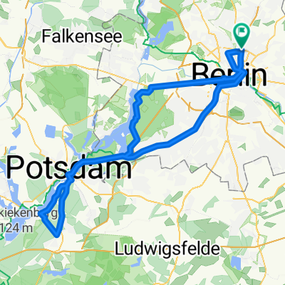
Training round of 61.24 km in North Berlin
- -:--
- Duration
- 59.3 km
- Distance
- 166 m
- Ascent
- 162 m
- Descent
- ---
- Avg. speed
- 68 m
- Max. altitude

Route quality
Waytypes & surfaces along the route
Waytypes
Path
14.2 km
(24 %)
Road
5.9 km
(10 %)
Surfaces
Paved
49.2 km
(83 %)
Asphalt
49.2 km
(83 %)
Undefined
10.1 km
(17 %)
Continue with Bikemap
Use, edit, or download this cycling route
You would like to ride Training Nord 60 Lehnitz or customize it for your own trip? Here is what you can do with this Bikemap route:
Free features
- Save this route as favorite or in collections
- Copy & plan your own version of this route
- Sync your route with Garmin or Wahoo
Premium features
Free trial for 3 days, or one-time payment. More about Bikemap Premium.
- Navigate this route on iOS & Android
- Export a GPX / KML file of this route
- Create your custom printout (try it for free)
- Download this route for offline navigation
Discover more Premium features.
Get Bikemap PremiumFrom our community
Other popular routes starting in Gesundbrunnen
 Raus aus Berlin, anschlagen und zurück
- Distance
- 96.3 km
- Ascent
- 393 m
- Descent
- 403 m
- Location
- Gesundbrunnen, State of Berlin, Germany
 Feierabendrunde für den Norden
- Distance
- 67.1 km
- Ascent
- 61 m
- Descent
- 56 m
- Location
- Gesundbrunnen, State of Berlin, Germany
 Die Eberswalde Extension 2
- Distance
- 119.3 km
- Ascent
- 342 m
- Descent
- 342 m
- Location
- Gesundbrunnen, State of Berlin, Germany
 12 Strausberg Märkische Schweiz
- Distance
- 55.5 km
- Ascent
- 83 m
- Descent
- 83 m
- Location
- Gesundbrunnen, State of Berlin, Germany
 Training Nord 60 Lehnitz
- Distance
- 59.3 km
- Ascent
- 166 m
- Descent
- 162 m
- Location
- Gesundbrunnen, State of Berlin, Germany
 Teufelsberg Runde
- Distance
- 54 km
- Ascent
- 149 m
- Descent
- 146 m
- Location
- Gesundbrunnen, State of Berlin, Germany
 Grunewald Runde von Mitte aus
- Distance
- 44.6 km
- Ascent
- 165 m
- Descent
- 158 m
- Location
- Gesundbrunnen, State of Berlin, Germany
 Prenzlauer Berg <-> Wandlitz
- Distance
- 54.4 km
- Ascent
- 79 m
- Descent
- 79 m
- Location
- Gesundbrunnen, State of Berlin, Germany
Open it in the app