

Coole Tour
A cycling route starting in Hohenpeißenberg, Bavaria, Germany.
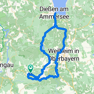
Overview
About this route
Small tour around Hohenpeissenberg featuring cool, partially technical trails. Then through Ammertal, to the Pollinger Biergarten ;-). After a nice snack, back to HPG. If you are in Pbg, at the foot of Hohen P., right after the railway bridge, turn right and climb the H.P. via St.Georg, this tour ends on a better note! You will then be rewarded with the most beautiful panoramic view of Bavaria.
Looking at:
Wetterstein, Karwendel, Ester mountains.
And on the other side:
Ammer and Starnberg lakes.
- -:--
- Duration
- 50.3 km
- Distance
- 513 m
- Ascent
- 513 m
- Descent
- ---
- Avg. speed
- ---
- Max. altitude
Continue with Bikemap
Use, edit, or download this cycling route
You would like to ride Coole Tour or customize it for your own trip? Here is what you can do with this Bikemap route:
Free features
- Save this route as favorite or in collections
- Copy & plan your own version of this route
- Sync your route with Garmin or Wahoo
Premium features
Free trial for 3 days, or one-time payment. More about Bikemap Premium.
- Navigate this route on iOS & Android
- Export a GPX / KML file of this route
- Create your custom printout (try it for free)
- Download this route for offline navigation
Discover more Premium features.
Get Bikemap PremiumFrom our community
Other popular routes starting in Hohenpeißenberg
 kenzenhütte
- Distance
- 49.2 km
- Ascent
- 820 m
- Descent
- 285 m
- Location
- Hohenpeißenberg, Bavaria, Germany
 Hohenpbg WN Bernried Seeshaupt Etting
- Distance
- 61 km
- Ascent
- 404 m
- Descent
- 504 m
- Location
- Hohenpeißenberg, Bavaria, Germany
 Coole Tour CLONED FROM ROUTE 988130
- Distance
- 50.3 km
- Ascent
- 513 m
- Descent
- 513 m
- Location
- Hohenpeißenberg, Bavaria, Germany
 Hohenpeißenberg - Weilheim
- Distance
- 21 km
- Ascent
- 29 m
- Descent
- 447 m
- Location
- Hohenpeißenberg, Bavaria, Germany
 HP - Diessen
- Distance
- 65.2 km
- Ascent
- 319 m
- Descent
- 318 m
- Location
- Hohenpeißenberg, Bavaria, Germany
 Illach
- Distance
- 47.7 km
- Ascent
- 253 m
- Descent
- 252 m
- Location
- Hohenpeißenberg, Bavaria, Germany
 Hohenpeißenberg - Forst - Schongau - Hohenpeißenberg
- Distance
- 45.9 km
- Ascent
- 637 m
- Descent
- 636 m
- Location
- Hohenpeißenberg, Bavaria, Germany
 Kenzenhütte
- Distance
- 101.3 km
- Ascent
- 710 m
- Descent
- 710 m
- Location
- Hohenpeißenberg, Bavaria, Germany
Open it in the app