


Ovada1
- 20.5 km
- 595 m
- 595 m
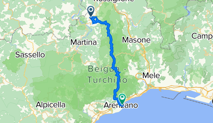
- Casavecchia, Liguria, Italy
A cycling route starting in Casavecchia, Liguria, Italy.
Overview
Orario inizio: 09/11/2016 08:07
Orario fine: 09/11/2016 15:52
Distanza: 24,6 km (07:44)
Tempo movimento: 04:33
Velocità media: 3,18 km/h
Velocità media mov.: 5,41 km/h
Max. Velocità: 31,38km/h
Altitudine minima: -28 m
Altitudine massima: 1102 m
Velocità di salita: 225 m/h
Velocità di discesa: -394,2 m/h
Dislivello positivo: 784 m
Perdita di elevazione: -1425 m
Tempo di salita: 03:29
Tempo di discesa: 03:36
created this 4 years ago
Continue with Bikemap
You would like to ride tiglieto arenzano2016-09-11 08:07 or customize it for your own trip? Here is what you can do with this Bikemap route:
Free trial for 3 days, or one-time payment. More about Bikemap Premium.
Discover more Premium features.
Get Bikemap PremiumFrom our community
Open it in the app


