

4 folyó túra (Nahe-Saar-Mosel-Rajna)
A cycling route starting in Bad Münster am Stein-Ebernburg, Rhineland-Palatinate, Germany.
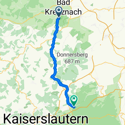
Overview
About this route
2005.07.26-29.
össztáv: 480 km,
összidő: 25h 06p
átlag: 19,1 km/h
max seb.: 53,5 km/h
Nahe a megtett irányban hegyre visz, Saar mentén uncsi, Mosel vadregényes, végig szőlőültetvényekkel, Rajna mentén sok vár, apró parti települések.
Többnyire tükörsima aszfalt, helyenként erdei út és murva. Rizling elsőrendű!!!
- -:--
- Duration
- 440.5 km
- Distance
- 0 m
- Ascent
- 0 m
- Descent
- ---
- Avg. speed
- ---
- Avg. speed
Route highlights
Points of interest along the route
Point of interest after 103.5 km
Első nap vége. 114 km, 6h 44p Naheradweg útvonala
Point of interest after 213.7 km
2. nap vége. 116 km, 5h 50p.
Point of interest after 320.5 km
3. nap vége. 114km, 5h 30p.
Continue with Bikemap
Use, edit, or download this cycling route
You would like to ride 4 folyó túra (Nahe-Saar-Mosel-Rajna) or customize it for your own trip? Here is what you can do with this Bikemap route:
Free features
- Save this route as favorite or in collections
- Copy & plan your own version of this route
- Split it into stages to create a multi-day tour
- Sync your route with Garmin or Wahoo
Premium features
Free trial for 3 days, or one-time payment. More about Bikemap Premium.
- Navigate this route on iOS & Android
- Export a GPX / KML file of this route
- Create your custom printout (try it for free)
- Download this route for offline navigation
Discover more Premium features.
Get Bikemap PremiumFrom our community
Other popular routes starting in Bad Münster am Stein-Ebernburg
 Alsenztal
- Distance
- 49.8 km
- Ascent
- 336 m
- Descent
- 158 m
- Location
- Bad Münster am Stein-Ebernburg, Rhineland-Palatinate, Germany
 Bad Kreuznach Nord Hin
- Distance
- 21.8 km
- Ascent
- 0 m
- Descent
- 0 m
- Location
- Bad Münster am Stein-Ebernburg, Rhineland-Palatinate, Germany
 Lange Radrunde durch Bad Kreuznach
- Distance
- 53 km
- Ascent
- 435 m
- Descent
- 435 m
- Location
- Bad Münster am Stein-Ebernburg, Rhineland-Palatinate, Germany
 An der Nahe
- Distance
- 47 km
- Ascent
- 376 m
- Descent
- 264 m
- Location
- Bad Münster am Stein-Ebernburg, Rhineland-Palatinate, Germany
 Heimatnah 4.Etappe Naheradweg 2.Teil
- Distance
- 64.4 km
- Ascent
- 340 m
- Descent
- 199 m
- Location
- Bad Münster am Stein-Ebernburg, Rhineland-Palatinate, Germany
 2025 Tag 5 Bad Münster-Allenbach
- Distance
- 70.4 km
- Ascent
- 1,201 m
- Descent
- 831 m
- Location
- Bad Münster am Stein-Ebernburg, Rhineland-Palatinate, Germany
 Nahe - Bingen - Mainz
- Distance
- 58.5 km
- Ascent
- 60 m
- Descent
- 83 m
- Location
- Bad Münster am Stein-Ebernburg, Rhineland-Palatinate, Germany
 Kurze Naherunde
- Distance
- 24.3 km
- Ascent
- 237 m
- Descent
- 237 m
- Location
- Bad Münster am Stein-Ebernburg, Rhineland-Palatinate, Germany
Open it in the app