

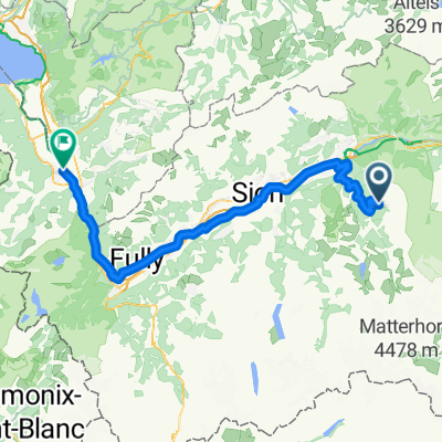
Tour du val d'Anniviers par la route
A cycling route starting in Chippis, Valais, Switzerland.
Overview
About this route
- -:--
- Duration
- 35.7 km
- Distance
- 876 m
- Ascent
- 876 m
- Descent
- ---
- Avg. speed
- ---
- Max. altitude
Route quality
Waytypes & surfaces along the route
Waytypes
Road
20.7 km
(58 %)
Quiet road
3.6 km
(10 %)
Undefined
11.4 km
(32 %)
Surfaces
Paved
1.8 km
(5 %)
Asphalt
1.8 km
(5 %)
Undefined
33.9 km
(95 %)
Continue with Bikemap
Use, edit, or download this cycling route
You would like to ride Tour du val d'Anniviers par la route or customize it for your own trip? Here is what you can do with this Bikemap route:
Free features
- Save this route as favorite or in collections
- Copy & plan your own version of this route
- Sync your route with Garmin or Wahoo
Premium features
Free trial for 3 days, or one-time payment. More about Bikemap Premium.
- Navigate this route on iOS & Android
- Export a GPX / KML file of this route
- Create your custom printout (try it for free)
- Download this route for offline navigation
Discover more Premium features.
Get Bikemap PremiumFrom our community
Other popular routes starting in Chippis
 Lac de Moiry
- Distance
- 19.1 km
- Ascent
- 1,245 m
- Descent
- 100 m
- Location
- Chippis, Valais, Switzerland
 Vissoie - brasilianer
- Distance
- 42.3 km
- Ascent
- 1,784 m
- Descent
- 2,484 m
- Location
- Chippis, Valais, Switzerland
 Tour du val d'Anniviers par la route
- Distance
- 35.7 km
- Ascent
- 876 m
- Descent
- 876 m
- Location
- Chippis, Valais, Switzerland
 Chippis - Monthey
- Distance
- 89.3 km
- Ascent
- 1,171 m
- Descent
- 2,450 m
- Location
- Chippis, Valais, Switzerland
 Parcours n°3 - Hôtel Weisshorn
- Distance
- 23.9 km
- Ascent
- 899 m
- Descent
- 897 m
- Location
- Chippis, Valais, Switzerland
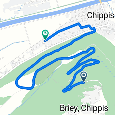 De Route de Briey à Rue des Clives
- Distance
- 5.7 km
- Ascent
- 0 m
- Descent
- 442 m
- Location
- Chippis, Valais, Switzerland
 Gravel Sierre Varen rive droite
- Distance
- 87.4 km
- Ascent
- 2,047 m
- Descent
- 2,040 m
- Location
- Chippis, Valais, Switzerland
 Tignousa_Saint Luc
- Distance
- 33.8 km
- Ascent
- 1,194 m
- Descent
- 1,685 m
- Location
- Chippis, Valais, Switzerland
Open it in the app