![[五星]分段環島-首部曲-永和到清水](/_next/static/media/contour-lines-light-small.cafd5e5d.avif)
![[五星]分段環島-首部曲-永和到清水](https://media.bikemap.net/routes/98905/staticmaps/in_cba9c0d3-caf2-4f27-b1e4-472c0ba70923_694x400_bikemap-2021-3D-static.png)
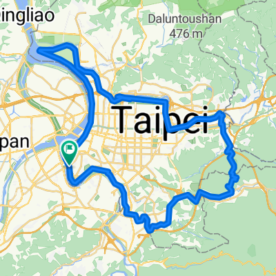
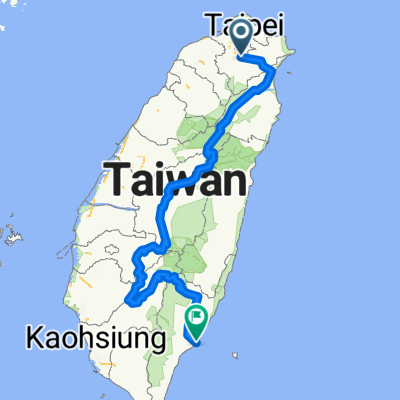
[五星]分段環島-首部曲-永和到清水
A cycling route starting in Banqiao District, Taipei, Taiwan.
Overview
About this route
- -:--
- Duration
- 172.5 km
- Distance
- 332 m
- Ascent
- 340 m
- Descent
- ---
- Avg. speed
- ---
- Max. altitude
Route highlights
Points of interest along the route
Point of interest after 0 km
Point of interest after 11.4 km
新莊會合點
Point of interest after 38.8 km
景點_復興空廚
Point of interest after 38.9 km
DHL Taipei Gateway
Point of interest after 69.3 km
休息點_永安漁港
Point of interest after 89.7 km
南寮午餐
Point of interest after 108.4 km
休息點_龍鳳港
Point of interest after 109.2 km
龍鳳港_假日之森
Point of interest after 137.6 km
熱門景點_馬家莊
Point of interest after 139.9 km
休息點_通宵媽祖廟
Point of interest after 140 km
熱門景點_通霄花田
Point of interest after 165.2 km
景點_高美溼地
Point of interest after 168.6 km
休息點_加油站
Continue with Bikemap
Use, edit, or download this cycling route
You would like to ride [五星]分段環島-首部曲-永和到清水 or customize it for your own trip? Here is what you can do with this Bikemap route:
Free features
- Save this route as favorite or in collections
- Copy & plan your own version of this route
- Split it into stages to create a multi-day tour
- Sync your route with Garmin or Wahoo
Premium features
Free trial for 3 days, or one-time payment. More about Bikemap Premium.
- Navigate this route on iOS & Android
- Export a GPX / KML file of this route
- Create your custom printout (try it for free)
- Download this route for offline navigation
Discover more Premium features.
Get Bikemap PremiumFrom our community
Other popular routes starting in Banqiao District
 環大台北
環大台北- Distance
- 160.8 km
- Ascent
- 584 m
- Descent
- 576 m
- Location
- Banqiao District, Taipei, Taiwan
 觀音山凌雲路-遊客中心
- Distance
- 8 km
- Ascent
- 433 m
- Descent
- 84 m
- Location
- Banqiao District, Taipei, Taiwan
 台北市一圈
台北市一圈- Distance
- 68.8 km
- Ascent
- 207 m
- Descent
- 211 m
- Location
- Banqiao District, Taipei, Taiwan
 新店-北宜-礁溪
- Distance
- 61.1 km
- Ascent
- 2,514 m
- Descent
- 2,331 m
- Location
- Banqiao District, Taipei, Taiwan
 中央山脈一條鞭
- Distance
- 690.1 km
- Ascent
- 8,446 m
- Descent
- 8,466 m
- Location
- Banqiao District, Taipei, Taiwan
 碧潭-獅子頭山
- Distance
- 12.1 km
- Ascent
- 704 m
- Descent
- 80 m
- Location
- Banqiao District, Taipei, Taiwan
 輪霸西濱200
- Distance
- 203.4 km
- Ascent
- 204 m
- Descent
- 203 m
- Location
- Banqiao District, Taipei, Taiwan
 新北南環110
- Distance
- 64.7 km
- Ascent
- 209 m
- Descent
- 209 m
- Location
- Banqiao District, Taipei, Taiwan
Open it in the app