

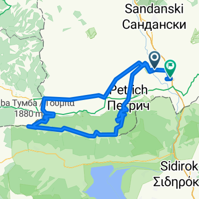
Беласица
A cycling route starting in Petrich, Blagoevgrad, Bulgaria.OverviewAbout this route
The route starts from General Todorov, climbs the peak Kongur, and follows the ridge to the peak Tumba. Then descends and proceeds self-propelled to Marikostinovo.
- -:--
- Duration
- 131.9 km
- Distance
- 2,396 m
- Ascent
- 2,394 m
- Descent
- ---
- Avg. speed
- ---
- Max. altitude
al.lazarovcreated this 14 years ago
Free features
- Save this route as favorite or in collections
- Copy & plan your own version of this route
- Split it into stages to create a multi-day tour
- Sync your route with Garmin or Wahoo
Premium features
Free trial for 3 days, or one-time payment. More about Bikemap Premium.
- Navigate this route on iOS & Android
- Export a GPX / KML file of this route
- Create your custom printout (try it for free)
- Download this route for offline navigation
Discover more Premium features.
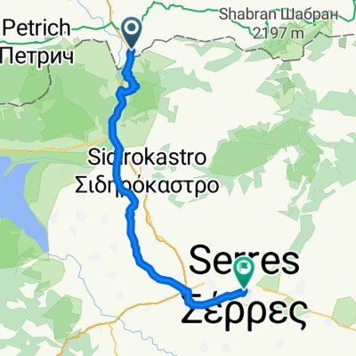
Get Bikemap Premium- BA 005 - KULATA - SERRES
- 57.6 km
- 239 m
- 274 m
- Petrich, Blagoevgrad, Bulgaria
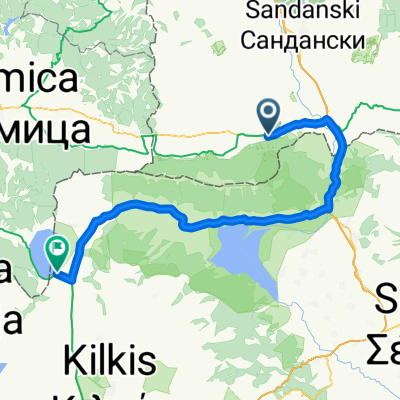
- General Todorov - Katunci - Belyovo - Katunci - Kulata
- 53.7 km
- 953 m
- 1,018 m
- Petrich, Blagoevgrad, Bulgaria
- Велообиколка Беласица - ден 1
- 88.4 km
- 389 m
- 438 m
- Petrich, Blagoevgrad, Bulgaria
- Беласица
- 131.9 km
- 2,396 m
- 2,394 m
- Petrich, Blagoevgrad, Bulgaria
- Steady ride
- 35.3 km
- 279 m
- 275 m
- Petrich, Blagoevgrad, Bulgaria
- Petrich - Gotze Delchev (test route)
- 69.8 km
- 1,479 m
- 1,131 m
- Petrich, Blagoevgrad, Bulgaria
- Петрич - х.Беласица
- 7.5 km
- 612 m
- 152 m
- Petrich, Blagoevgrad, Bulgaria


Open it in the app