

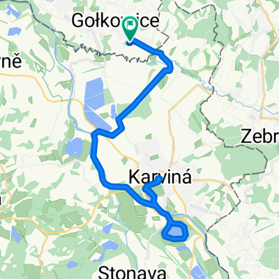
Gołkowice-Krzyżanowice-Racibórz-Buków-Hat-Stary Bohumin-Dolny Lutynia-Karvina-Gołkowice
A cycling route starting in Gołkowice, Silesian Voivodeship, Poland.
Overview
About this route
The route along the Oder mostly runs on embankments; in the Czech Republic, there are a few hills.
- -:--
- Duration
- 103 km
- Distance
- 275 m
- Ascent
- 275 m
- Descent
- ---
- Avg. speed
- ---
- Max. altitude
Continue with Bikemap
Use, edit, or download this cycling route
You would like to ride Gołkowice-Krzyżanowice-Racibórz-Buków-Hat-Stary Bohumin-Dolny Lutynia-Karvina-Gołkowice or customize it for your own trip? Here is what you can do with this Bikemap route:
Free features
- Save this route as favorite or in collections
- Copy & plan your own version of this route
- Split it into stages to create a multi-day tour
- Sync your route with Garmin or Wahoo
Premium features
Free trial for 3 days, or one-time payment. More about Bikemap Premium.
- Navigate this route on iOS & Android
- Export a GPX / KML file of this route
- Create your custom printout (try it for free)
- Download this route for offline navigation
Discover more Premium features.
Get Bikemap PremiumFrom our community
Other popular routes starting in Gołkowice
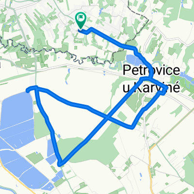
 golkowice prstna (karwina rynek)
- Distance
- 27.1 km
- Ascent
- 162 m
- Descent
- 162 m
- Location
- Gołkowice, Silesian Voivodeship, Poland
 Na Górze D do Na Górze D
- Distance
- 33.4 km
- Ascent
- 158 m
- Descent
- 216 m
- Location
- Gołkowice, Silesian Voivodeship, Poland
 Droga do i z pracy
- Distance
- 35.9 km
- Ascent
- 268 m
- Descent
- 267 m
- Location
- Gołkowice, Silesian Voivodeship, Poland
 Na Górze D do Na Górze D
- Distance
- 15.2 km
- Ascent
- 119 m
- Descent
- 181 m
- Location
- Gołkowice, Silesian Voivodeship, Poland
 Gołkowice-Krzyżanowice-Racibórz-Buków-Hat-Stary Bohumin-Dolny Lutynia-Karvina-Gołkowice
- Distance
- 103 km
- Ascent
- 275 m
- Descent
- 275 m
- Location
- Gołkowice, Silesian Voivodeship, Poland
 Jastrzębie -> Cierlicko -> Jastrzębie
- Distance
- 69.3 km
- Ascent
- 415 m
- Descent
- 428 m
- Location
- Gołkowice, Silesian Voivodeship, Poland
 Kamienne kule. Milosova
- Distance
- 184.3 km
- Ascent
- 963 m
- Descent
- 961 m
- Location
- Gołkowice, Silesian Voivodeship, Poland
 Jastrzębie - Góra św. Anny
- Distance
- 102.4 km
- Ascent
- 236 m
- Descent
- 137 m
- Location
- Gołkowice, Silesian Voivodeship, Poland
Open it in the app