

Kocourkovská padesátka - 16.7.2011
A cycling route starting in Přelouč, Pardubický kraj, Czechia.
Overview
About this route
Planned route for the geocaching event 'Kocourkovská padesátka'.
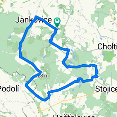
Route: Přelouč - Benešovice - Brloh - Pelechov - Lipoltice - Urbanice - Ledec - Svojšice - Rašovy (refreshments) - Turkovice - Bumbalka - Semtěš - Bílé Podolí - Brambory - Svobodná Ves - Morašice - Zdechovice (refreshments) - Řečany n.L. - Kladruby n.L. - Semín - Břehy (Výrov, finish at the garden of the Cikánka pub)
Start from Přelouč on quieter 3rd-class roads, country and forest tracks – unsuitable for road bikes, but a full mountain bike is not strictly necessary either.
This route is a suggestion for a trip from Přelouč. Starting from an elevation of about 215 metres, you climb to the highest point of the route, after Turkovice, at around 360 metres. Attention! There's a steeper descent from Husinec to Semtěš! You'll descend the ridge of the Železné hory into the Čáslav Basin. You'll climb back into the Železné hory after Svobodná Ves (about 100 metres elevation gain), and the last 20 km are almost entirely flat as you ride through the Polabí plains.
- -:--
- Duration
- 49.3 km
- Distance
- 0 m
- Ascent
- 0 m
- Descent
- ---
- Avg. speed
- ---
- Max. altitude
Route quality
Waytypes & surfaces along the route
Waytypes
Road
33.5 km
(68 %)
Quiet road
8.9 km
(18 %)
Surfaces
Paved
2 km
(4 %)
Unpaved
5.4 km
(11 %)
Gravel
2.5 km
(5 %)
Asphalt
2 km
(4 %)
Route highlights
Points of interest along the route
Point of interest after 4.6 km
Pelechovské údolí
Point of interest after 12.1 km
zřícenina tvrze ve Svojšicích
Point of interest after 14.5 km
občerstvení u Moře
Point of interest after 17.8 km
nejvyšší bod trasy (362 m.n.m.)
Point of interest after 20.2 km
rozhledy z hřebenu železných hor nad Semtěší
Point of interest after 21 km
věž tvrze v Semtěši
Point of interest after 29.2 km
328 m.n.m. - a teď už jenom dolů a po rovině
Point of interest after 33.6 km
Zdechovice - občerstvení, zámek
Point of interest after 37.9 km
dřevěný kostelík v Řečanech n.L.
Point of interest after 40.1 km
hřebčín Kladruby n.L.
Point of interest after 43.4 km
Semínský přesyp
Point of interest after 44.7 km
aquadukt
Continue with Bikemap
Use, edit, or download this cycling route
You would like to ride Kocourkovská padesátka - 16.7.2011 or customize it for your own trip? Here is what you can do with this Bikemap route:
Free features
- Save this route as favorite or in collections
- Copy & plan your own version of this route
- Sync your route with Garmin or Wahoo
Premium features
Free trial for 3 days, or one-time payment. More about Bikemap Premium.
- Navigate this route on iOS & Android
- Export a GPX / KML file of this route
- Create your custom printout (try it for free)
- Download this route for offline navigation
Discover more Premium features.
Get Bikemap PremiumFrom our community
Other popular routes starting in Přelouč
 Pardubice_Hradec_Prelouc_Opatovice Kanal
- Distance
- 63.8 km
- Ascent
- 252 m
- Descent
- 252 m
- Location
- Přelouč, Pardubický kraj, Czechia
 z Brlohu do Brlohu
- Distance
- 25.7 km
- Ascent
- 0 m
- Descent
- 0 m
- Location
- Přelouč, Pardubický kraj, Czechia
 Přelouč Lepějovice Choltice Březinka Litošice Přelouč
- Distance
- 36.1 km
- Ascent
- 312 m
- Descent
- 311 m
- Location
- Přelouč, Pardubický kraj, Czechia
 kolečko Přelouč - Semtěš - Morašice - Přelouč
- Distance
- 30.4 km
- Ascent
- 322 m
- Descent
- 323 m
- Location
- Přelouč, Pardubický kraj, Czechia
 Kocourkovské kolečko II
- Distance
- 49.4 km
- Ascent
- 451 m
- Descent
- 448 m
- Location
- Přelouč, Pardubický kraj, Czechia
 Přelouč, Semín, Klamoš, Rohoznice, Vlčí Habřina, Přelouč
- Distance
- 49.2 km
- Ascent
- 177 m
- Descent
- 173 m
- Location
- Přelouč, Pardubický kraj, Czechia
 Iron Mountains Open Air Training Camp 2013
- Distance
- 77.2 km
- Ascent
- 774 m
- Descent
- 774 m
- Location
- Přelouč, Pardubický kraj, Czechia
 Kocourkovská padesátka - 16.7.2011
- Distance
- 49.3 km
- Ascent
- 0 m
- Descent
- 0 m
- Location
- Přelouč, Pardubický kraj, Czechia
Open it in the app