

Kaiserstuhl-Radweg
A cycling route starting in Gottenheim, Baden-Wurttemberg, Germany.
Overview
About this route
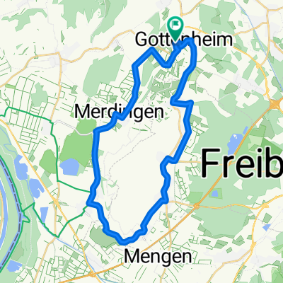
The Kaiserstuhl Cycle Path takes you on a circular route around the famous vineyard mountain of Kaiserstuhl.
- -:--
- Duration
- 72.7 km
- Distance
- 351 m
- Ascent
- 274 m
- Descent
- ---
- Avg. speed
- 269 m
- Max. altitude

Route quality
Waytypes & surfaces along the route
Waytypes
Track
26.9 km
(37 %)
Quiet road
24.7 km
(34 %)
Surfaces
Paved
58.9 km
(81 %)
Unpaved
5.8 km
(8 %)
Asphalt
48.7 km
(67 %)
Paved (undefined)
10.2 km
(14 %)
Continue with Bikemap
Use, edit, or download this cycling route
You would like to ride Kaiserstuhl-Radweg or customize it for your own trip? Here is what you can do with this Bikemap route:
Free features
- Save this route as favorite or in collections
- Copy & plan your own version of this route
- Sync your route with Garmin or Wahoo
Premium features
Free trial for 3 days, or one-time payment. More about Bikemap Premium.
- Navigate this route on iOS & Android
- Export a GPX / KML file of this route
- Create your custom printout (try it for free)
- Download this route for offline navigation
Discover more Premium features.
Get Bikemap PremiumFrom our community
Other popular routes starting in Gottenheim
 Gottenheim Mooswald Gottenheim
- Distance
- 60.1 km
- Ascent
- 153 m
- Descent
- 155 m
- Location
- Gottenheim, Baden-Wurttemberg, Germany
 Kaiserstuhl-Runde
- Distance
- 60.1 km
- Ascent
- 0 m
- Descent
- 0 m
- Location
- Gottenheim, Baden-Wurttemberg, Germany
 March-Reute-Teningen-Riegel-Bötzingen
- Distance
- 42.5 km
- Ascent
- 74 m
- Descent
- 77 m
- Location
- Gottenheim, Baden-Wurttemberg, Germany
 Kaiserstuhl-Radweg
- Distance
- 72.7 km
- Ascent
- 351 m
- Descent
- 274 m
- Location
- Gottenheim, Baden-Wurttemberg, Germany
 Kaiserstuhl
- Distance
- 49.8 km
- Ascent
- 190 m
- Descent
- 190 m
- Location
- Gottenheim, Baden-Wurttemberg, Germany
 Um den Tuniberg
- Distance
- 28.2 km
- Ascent
- 96 m
- Descent
- 93 m
- Location
- Gottenheim, Baden-Wurttemberg, Germany
 gundelfingen denzlingen emmendingen teningen eichstetten bötzingen gottenheim
- Distance
- 44.8 km
- Ascent
- 84 m
- Descent
- 86 m
- Location
- Gottenheim, Baden-Wurttemberg, Germany
 Gottenheim - Breisach - Hartheim - Rimsingen - Merdingen- Gottenheim
- Distance
- 42 km
- Ascent
- 53 m
- Descent
- 53 m
- Location
- Gottenheim, Baden-Wurttemberg, Germany
Open it in the app