

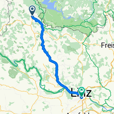
Haslach/Svaty Tomas/Stausee/Afiesl/Haslach
A cycling route starting in Schlägl, Upper Austria, Austria.
Overview
About this route
Diese Route kann man auch mit einem Trekkingbike bewältigen.
- -:--
- Duration
- 45.9 km
- Distance
- 0 m
- Ascent
- 0 m
- Descent
- ---
- Avg. speed
- ---
- Max. altitude

Route quality
Waytypes & surfaces along the route
Waytypes
Road
26.1 km
(57 %)
Track
14.7 km
(32 %)
Surfaces
Paved
36.7 km
(80 %)
Unpaved
6 km
(13 %)
Asphalt
32.1 km
(70 %)
Gravel
6 km
(13 %)
Continue with Bikemap
Use, edit, or download this cycling route
You would like to ride Haslach/Svaty Tomas/Stausee/Afiesl/Haslach or customize it for your own trip? Here is what you can do with this Bikemap route:
Free features
- Save this route as favorite or in collections
- Copy & plan your own version of this route
- Sync your route with Garmin or Wahoo
Premium features
Free trial for 3 days, or one-time payment. More about Bikemap Premium.
- Navigate this route on iOS & Android
- Export a GPX / KML file of this route
- Create your custom printout (try it for free)
- Download this route for offline navigation
Discover more Premium features.
Get Bikemap PremiumFrom our community
Other popular routes starting in Schlägl
 Haslach/Svaty Tomas/Stausee/Afiesl/Haslach
- Distance
- 45.9 km
- Ascent
- 0 m
- Descent
- 0 m
- Location
- Schlägl, Upper Austria, Austria
 Rohrbach-Berg - Nove Udolí
- Distance
- 57 km
- Ascent
- 737 m
- Descent
- 513 m
- Location
- Schlägl, Upper Austria, Austria
 Rohrbach-Peilstein-Schlägel-via.Gr.Mühl-Haslach-Ro
- Distance
- 37.4 km
- Ascent
- 883 m
- Descent
- 877 m
- Location
- Schlägl, Upper Austria, Austria
 Haslach
- Distance
- 47.8 km
- Ascent
- 884 m
- Descent
- 881 m
- Location
- Schlägl, Upper Austria, Austria
 Rohrbach nach Wien 2017
- Distance
- 264.6 km
- Ascent
- 151 m
- Descent
- 555 m
- Location
- Schlägl, Upper Austria, Austria
 2010-Tag26: Furthmühle-Passau
- Distance
- 80.7 km
- Ascent
- 433 m
- Descent
- 643 m
- Location
- Schlägl, Upper Austria, Austria
 Grüner Weg, Aigen-Schlägl nach Bahnhofplatz, Linz
- Distance
- 59.5 km
- Ascent
- 804 m
- Descent
- 1,110 m
- Location
- Schlägl, Upper Austria, Austria
 Ameisbergrunde
- Distance
- 44.5 km
- Ascent
- 1,029 m
- Descent
- 1,027 m
- Location
- Schlägl, Upper Austria, Austria
Open it in the app