

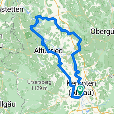
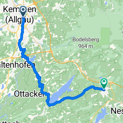
schnelle Durach - Rottachspeicher - Martinszell Runde
A cycling route starting in Kempten (Allgäu), Bavaria, Germany.
Overview
About this route
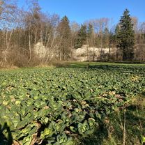
Cozy round for the workout.
- -:--
- Duration
- 39.6 km
- Distance
- 399 m
- Ascent
- 404 m
- Descent
- ---
- Avg. speed
- 942 m
- Max. altitude
Route quality
Waytypes & surfaces along the route
Waytypes
Quiet road
17 km
(43 %)
Road
8.7 km
(22 %)
Surfaces
Paved
36.4 km
(92 %)
Unpaved
2.4 km
(6 %)
Asphalt
36.4 km
(92 %)
Pebblestone
1.2 km
(3 %)
Continue with Bikemap
Use, edit, or download this cycling route
You would like to ride schnelle Durach - Rottachspeicher - Martinszell Runde or customize it for your own trip? Here is what you can do with this Bikemap route:
Free features
- Save this route as favorite or in collections
- Copy & plan your own version of this route
- Sync your route with Garmin or Wahoo
Premium features
Free trial for 3 days, or one-time payment. More about Bikemap Premium.
- Navigate this route on iOS & Android
- Export a GPX / KML file of this route
- Create your custom printout (try it for free)
- Download this route for offline navigation
Discover more Premium features.
Get Bikemap PremiumFrom our community
Other popular routes starting in Kempten (Allgäu)
 Kempten (Allgäu) nach Bergs, Altusried
- Distance
- 12.2 km
- Ascent
- 138 m
- Descent
- 99 m
- Location
- Kempten (Allgäu), Bavaria, Germany
 kleine Abendrunde Kempten - Martinszell
- Distance
- 30.3 km
- Ascent
- 185 m
- Descent
- 186 m
- Location
- Kempten (Allgäu), Bavaria, Germany
 Allgäu - Kemptner Illerrunde
- Distance
- 66 km
- Ascent
- 1,463 m
- Descent
- 1,457 m
- Location
- Kempten (Allgäu), Bavaria, Germany
 Allgäu - Kemptner Illerrunde
- Distance
- 66 km
- Ascent
- 886 m
- Descent
- 881 m
- Location
- Kempten (Allgäu), Bavaria, Germany
 Allgäu - eine Route zum Geniessen
- Distance
- 62.2 km
- Ascent
- 797 m
- Descent
- 797 m
- Location
- Kempten (Allgäu), Bavaria, Germany
 Trainingsrunde
- Distance
- 41.5 km
- Ascent
- 750 m
- Descent
- 754 m
- Location
- Kempten (Allgäu), Bavaria, Germany
 Isny - Kreuzlingen
- Distance
- 133.2 km
- Ascent
- 1,005 m
- Descent
- 1,261 m
- Location
- Kempten (Allgäu), Bavaria, Germany
 Füssener Straße, Kempten (Allgäu) nach Sebastian-Kneipp-Weg, Oy-Mittelberg
- Distance
- 23.1 km
- Ascent
- 489 m
- Descent
- 217 m
- Location
- Kempten (Allgäu), Bavaria, Germany
Open it in the app