

Südsteiermark
A cycling route starting in Unterpremstätten, Styria, Austria.
Overview
About this route
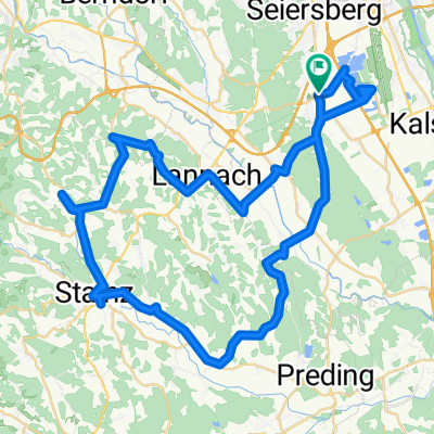
Start Unterpremstetten - Dietersdorf - Preding - Zehndorf - St. Nikolai - Seggauberg - Heimschuh - Schönegg - Gamlitz - Sulztal an der Weinstrasse - Ciringa - Zieregg - Ehrenhausen - St. Veit - Linz - Pichl - Hainsdorf - Obergassl - Eichfeld - Gosdorf - Deutsch Goritz - Fluttendorf - Donnersdorf - Dietzen - Halbenrain
- -:--
- Duration
- 90.1 km
- Distance
- 528 m
- Ascent
- 636 m
- Descent
- ---
- Avg. speed
- ---
- Max. altitude
Route quality
Waytypes & surfaces along the route
Waytypes
Quiet road
16.2 km
(18 %)
Road
10.8 km
(12 %)
Surfaces
Paved
64 km
(71 %)
Unpaved
1.8 km
(2 %)
Asphalt
64 km
(71 %)
Gravel
1.8 km
(2 %)
Undefined
24.3 km
(27 %)
Continue with Bikemap
Use, edit, or download this cycling route
You would like to ride Südsteiermark or customize it for your own trip? Here is what you can do with this Bikemap route:
Free features
- Save this route as favorite or in collections
- Copy & plan your own version of this route
- Split it into stages to create a multi-day tour
- Sync your route with Garmin or Wahoo
Premium features
Free trial for 3 days, or one-time payment. More about Bikemap Premium.
- Navigate this route on iOS & Android
- Export a GPX / KML file of this route
- Create your custom printout (try it for free)
- Download this route for offline navigation
Discover more Premium features.
Get Bikemap PremiumFrom our community
Other popular routes starting in Unterpremstätten
 Südsteiermark
- Distance
- 90.1 km
- Ascent
- 528 m
- Descent
- 636 m
- Location
- Unterpremstätten, Styria, Austria
 UP-Feldkirchen-Graz-Thal/Eben-Steinberg-Hitzendorf-Doblegg-Tobelbad-Dobl-Zwaring-Wundschuh-SFZ
- Distance
- 64.8 km
- Ascent
- 420 m
- Descent
- 438 m
- Location
- Unterpremstätten, Styria, Austria
 Die West-Tour
- Distance
- 76.9 km
- Ascent
- 1,066 m
- Descent
- 1,064 m
- Location
- Unterpremstätten, Styria, Austria
 Über die süd-westl Hügeln
- Distance
- 54 km
- Ascent
- 564 m
- Descent
- 564 m
- Location
- Unterpremstätten, Styria, Austria
 Kalsdorf - Muttendorf - Dobl - Unterpremstätten
- Distance
- 46.9 km
- Ascent
- 239 m
- Descent
- 249 m
- Location
- Unterpremstätten, Styria, Austria
 Steiermark 3 - Südliche Mur
- Distance
- 76.7 km
- Ascent
- 172 m
- Descent
- 176 m
- Location
- Unterpremstätten, Styria, Austria
 Bike Graz 70.3 v003
- Distance
- 89.3 km
- Ascent
- 1,281 m
- Descent
- 1,239 m
- Location
- Unterpremstätten, Styria, Austria
 Südwestliche West-STEIERMARK 1
- Distance
- 63.9 km
- Ascent
- 437 m
- Descent
- 440 m
- Location
- Unterpremstätten, Styria, Austria
Open it in the app