

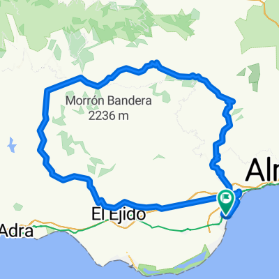
La Mojonera - Urbanizacion de Roquetas - Puerto de Roquetas - Paseo de aguadulce - Puerta de Aguadulce - Vicar - La Mojonera
A cycling route starting in Roquetas de Mar, Andalusia, Spain.
Overview
About this route
ALMOST THE ENTIRE ROUTE IS PAVED EXCEPT FOR A SECTION BETWEEN THE PROMENADES OF ROQUETAS AND AGUADULCE. YOU RIDE ALMOST THE WHOLE WAY ALONG THE BEACH, AND IN THE FIRST TUNNEL ON THE N-340 THERE IS A SPORT CLIMBING AREA. YOU CAN RETURN THE SAME WAY, BUT I GO BACK VIA VICAR TO VARY THE ROUTE A LITTLE.
- -:--
- Duration
- 43.8 km
- Distance
- 264 m
- Ascent
- 268 m
- Descent
- ---
- Avg. speed
- ---
- Max. altitude

Route highlights
Points of interest along the route

Point of interest after 24.5 km
AQUI HAY UNAS VISTAS DEL MAR MUY BONITAS, YO HE VISTO DELFINES CERCA DE LA PISCIFACTORIA. ES UN SITIO DE ESCALADA DE PORTIVA DESDE UN 5º A UN 7º
Continue with Bikemap
Use, edit, or download this cycling route
You would like to ride La Mojonera - Urbanizacion de Roquetas - Puerto de Roquetas - Paseo de aguadulce - Puerta de Aguadulce - Vicar - La Mojonera or customize it for your own trip? Here is what you can do with this Bikemap route:
Free features
- Save this route as favorite or in collections
- Copy & plan your own version of this route
- Sync your route with Garmin or Wahoo
Premium features
Free trial for 3 days, or one-time payment. More about Bikemap Premium.
- Navigate this route on iOS & Android
- Export a GPX / KML file of this route
- Create your custom printout (try it for free)
- Download this route for offline navigation
Discover more Premium features.
Get Bikemap PremiumFrom our community
Other popular routes starting in Roquetas de Mar
 Roquetas - Felix - Carcauz - CTP Corsario - Solanillo - Roquetas
- Distance
- 52.4 km
- Ascent
- 914 m
- Descent
- 912 m
- Location
- Roquetas de Mar, Andalusia, Spain
 De Calle Cruz Roja Española 19, Roquetas de Mar a Plaza de Manos Unidas 5, Roquetas de Mar
- Distance
- 22.6 km
- Ascent
- 430 m
- Descent
- 432 m
- Location
- Roquetas de Mar, Andalusia, Spain
 MI primera GR
- Distance
- 135.1 km
- Ascent
- 1,897 m
- Descent
- 1,898 m
- Location
- Roquetas de Mar, Andalusia, Spain
 La Mojonera - Urbanizacion de Roquetas - Puerto de Roquetas - Paseo de aguadulce - Puerta de Aguadulce - Vicar - La Mojonera
- Distance
- 43.8 km
- Ascent
- 264 m
- Descent
- 268 m
- Location
- Roquetas de Mar, Andalusia, Spain
 Playa Serena- Aguadulce- Roquetas- Weihnachtsmarkt- Playa Serena
- Distance
- 22.6 km
- Ascent
- 33 m
- Descent
- 34 m
- Location
- Roquetas de Mar, Andalusia, Spain
 ROQUETAS - RUTA PINTORESCA - ENIX (RAMBLA) - ROQUETAS
- Distance
- 43 km
- Ascent
- 853 m
- Descent
- 856 m
- Location
- Roquetas de Mar, Andalusia, Spain
 CAÑUELO
- Distance
- 62.6 km
- Ascent
- 1,272 m
- Descent
- 1,270 m
- Location
- Roquetas de Mar, Andalusia, Spain
 Roquetas - Cañuelo - Felix - Rambla Juan de Austria - Roquetas
- Distance
- 37.5 km
- Ascent
- 801 m
- Descent
- 803 m
- Location
- Roquetas de Mar, Andalusia, Spain
Open it in the app