
27. Scherdel-Frankenwaldtour 2012 - 100 km
A cycling route starting in Geroldsgrün, Bavaria, Germany.
Overview
About this route
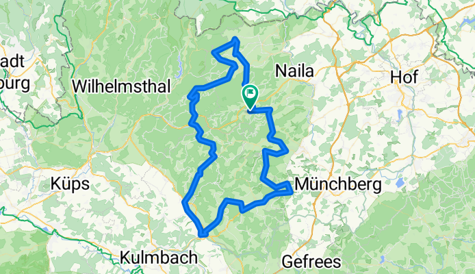
Im Rahmen der 27. WSV Scherdel-Frankenwaldtour 2012 am 1. Juli 2012 die Strecke mit rd. 100 km und ca. 1100 hm. Benutzen Sie bitte die vorhandenen Radwege.
- -:--
- Duration
- 97.2 km
- Distance
- 956 m
- Ascent
- 958 m
- Descent
- ---
- Avg. speed
- ---
- Max. altitude
Route quality
Waytypes & surfaces along the route
Waytypes
Road
44.4 km
(46 %)
Busy road
34 km
(35 %)
Surfaces
Paved
62.8 km
(65 %)
Unpaved
1.3 km
(1 %)
Asphalt
61.5 km
(63 %)
Gravel
1.3 km
(1 %)
Continue with Bikemap
Use, edit, or download this cycling route
You would like to ride 27. Scherdel-Frankenwaldtour 2012 - 100 km or customize it for your own trip? Here is what you can do with this Bikemap route:
Free features
- Save this route as favorite or in collections
- Copy & plan your own version of this route
- Split it into stages to create a multi-day tour
- Sync your route with Garmin or Wahoo
Premium features
Free trial for 3 days, or one-time payment. More about Bikemap Premium.
- Navigate this route on iOS & Android
- Export a GPX / KML file of this route
- Create your custom printout (try it for free)
- Download this route for offline navigation
Discover more Premium features.
Get Bikemap PremiumFrom our community
Other popular routes starting in Geroldsgrün
 Schwarzenbach/Wald Rundstrecke
- Distance
- 25.8 km
- Ascent
- 322 m
- Descent
- 322 m
- Location
- Geroldsgrün, Bavaria, Germany
 27. Scherdel-Frankenwaldtour 2012 - 100 km
- Distance
- 97.2 km
- Ascent
- 956 m
- Descent
- 958 m
- Location
- Geroldsgrün, Bavaria, Germany
 26. Scherdel-Frankenwaldtour 2011 - 130 km CLONED FROM ROUTE 989138
- Distance
- 123.5 km
- Ascent
- 962 m
- Descent
- 962 m
- Location
- Geroldsgrün, Bavaria, Germany
 FrankenwaldRunning_Spitzberg
- Distance
- 13.5 km
- Ascent
- 309 m
- Descent
- 309 m
- Location
- Geroldsgrün, Bavaria, Germany
 27. Scherdel-Frankenwaldtour 2012 - 80 km
- Distance
- 84.9 km
- Ascent
- 982 m
- Descent
- 983 m
- Location
- Geroldsgrün, Bavaria, Germany
 Samstagnachmittagstour
- Distance
- 57 km
- Ascent
- 466 m
- Descent
- 463 m
- Location
- Geroldsgrün, Bavaria, Germany
 27. Scherdel-Frankenwaldtour 2012 - 45 km
- Distance
- 45.9 km
- Ascent
- 443 m
- Descent
- 444 m
- Location
- Geroldsgrün, Bavaria, Germany
 Geroldsgruen_Heb
- Distance
- 83 km
- Ascent
- 833 m
- Descent
- 818 m
- Location
- Geroldsgrün, Bavaria, Germany
Open it in the app