EL MARCHAL - LAS VIÑAS
A cycling route starting in Aguadulce, Andalusia, Spain.
Overview
About this route
- -:--
- Duration
- 40 km
- Distance
- 1,177 m
- Ascent
- 1,177 m
- Descent
- ---
- Avg. speed
- 1,194 m
- Max. altitude
Route photos
Route quality
Waytypes & surfaces along the route
Waytypes
Quiet road
6.8 km
(17 %)
Road
5.6 km
(14 %)
Surfaces
Paved
17.6 km
(44 %)
Unpaved
10.8 km
(27 %)
Asphalt
17.6 km
(44 %)
Gravel
5.2 km
(13 %)
Continue with Bikemap
Use, edit, or download this cycling route
You would like to ride EL MARCHAL - LAS VIÑAS or customize it for your own trip? Here is what you can do with this Bikemap route:
Free features
- Save this route as favorite or in collections
- Copy & plan your own version of this route
- Sync your route with Garmin or Wahoo
Premium features
Free trial for 3 days, or one-time payment. More about Bikemap Premium.
- Navigate this route on iOS & Android
- Export a GPX / KML file of this route
- Create your custom printout (try it for free)
- Download this route for offline navigation
Discover more Premium features.
Get Bikemap PremiumFrom our community
Other popular routes starting in Aguadulce
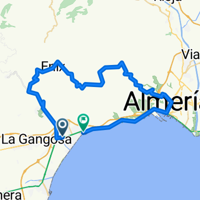
GRAN RUTA Roquetas-Alpujarra- Distance
- 133 km
- Ascent
- 2,240 m
- Descent
- 2,242 m
- Location
- Aguadulce, Andalusia, Spain
HIRMES- Distance
- 93.4 km
- Ascent
- 1,110 m
- Descent
- 1,110 m
- Location
- Aguadulce, Andalusia, Spain
EL PARADOR-MARCHAL-CHANATA- Distance
- 18.8 km
- Ascent
- 1,166 m
- Descent
- 120 m
- Location
- Aguadulce, Andalusia, Spain
Aguadulce-Casa- Distance
- 101 km
- Ascent
- 1,272 m
- Descent
- 878 m
- Location
- Aguadulce, Andalusia, Spain
PARADOR-TARTEL-CARCAUZ-FELIX- Distance
- 52.3 km
- Ascent
- 1,383 m
- Descent
- 1,380 m
- Location
- Aguadulce, Andalusia, Spain
G.R. Día de Andalucía 2014- Distance
- 150.7 km
- Ascent
- 3,017 m
- Descent
- 3,012 m
- Location
- Aguadulce, Andalusia, Spain
ERMITA HUÉCIJA - CHANATA- Distance
- 74.2 km
- Ascent
- 1,664 m
- Descent
- 1,667 m
- Location
- Aguadulce, Andalusia, Spain
AGUADULCE-FELIX-Peñón de BERNAL- Distance
- 38.8 km
- Ascent
- 909 m
- Descent
- 907 m
- Location
- Aguadulce, Andalusia, Spain
Open it in the app

