
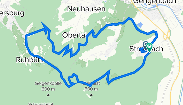
Strohbach
A cycling route starting in Gengenbach, Hesse, Germany.
Overview
About this route
- -:--
- Duration
- 18.6 km
- Distance
- 620 m
- Ascent
- 607 m
- Descent
- ---
- Avg. speed
- 537 m
- Max. altitude
Route quality
Waytypes & surfaces along the route
Waytypes
Track
9.9 km
(53 %)
Quiet road
7.6 km
(41 %)
Surfaces
Paved
4.1 km
(22 %)
Unpaved
10.2 km
(55 %)
Gravel
4.5 km
(24 %)
Asphalt
4.1 km
(22 %)
Continue with Bikemap
Use, edit, or download this cycling route
You would like to ride Strohbach or customize it for your own trip? Here is what you can do with this Bikemap route:
Free features
- Save this route as favorite or in collections
- Copy & plan your own version of this route
- Sync your route with Garmin or Wahoo
Premium features
Free trial for 3 days, or one-time payment. More about Bikemap Premium.
- Navigate this route on iOS & Android
- Export a GPX / KML file of this route
- Create your custom printout (try it for free)
- Download this route for offline navigation
Discover more Premium features.
Get Bikemap PremiumFrom our community
Other popular routes starting in Gengenbach
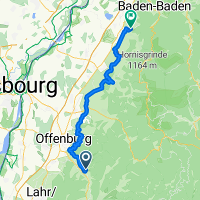
 Gengenbach - Hausach
- Distance
- 44.1 km
- Ascent
- 1,060 m
- Descent
- 1,014 m
- Location
- Gengenbach, Hesse, Germany
 Ausfahrt durch Steinach im Kinzigtal
- Distance
- 14.3 km
- Ascent
- 54 m
- Descent
- 28 m
- Location
- Gengenbach, Hesse, Germany
 7-Täler-Weg Gengenbach nach Biberach CLONED FROM ROUTE 1607693
- Distance
- 18.5 km
- Ascent
- 517 m
- Descent
- 495 m
- Location
- Gengenbach, Hesse, Germany
 Strohbach
- Distance
- 18.6 km
- Ascent
- 620 m
- Descent
- 607 m
- Location
- Gengenbach, Hesse, Germany
 Gengenbach-Offenburg-Schutterzell-Niederschopfheim-Zunsweier-Gengenbach
- Distance
- 54.2 km
- Ascent
- 89 m
- Descent
- 87 m
- Location
- Gengenbach, Hesse, Germany
 Von Gengenbach über Kornebene nach Steinenbach und zurück
- Distance
- 42.3 km
- Ascent
- 1,249 m
- Descent
- 1,257 m
- Location
- Gengenbach, Hesse, Germany
 3. Etappe von Gengenbach nach Bühl
- Distance
- 58.7 km
- Ascent
- 683 m
- Descent
- 695 m
- Location
- Gengenbach, Hesse, Germany
 3 tägige Scharzwaldtour - Tag 2
- Distance
- 51.1 km
- Ascent
- 1,634 m
- Descent
- 1,211 m
- Location
- Gengenbach, Hesse, Germany
Open it in the app