

Piesenkofen Richtung Thalmassing
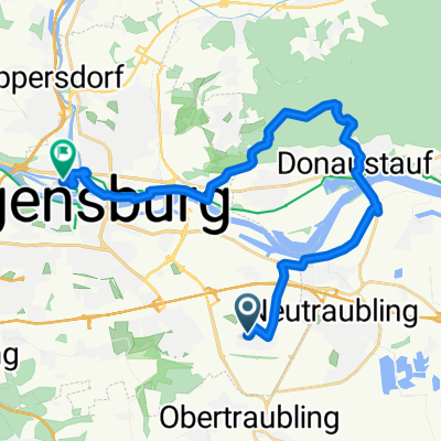
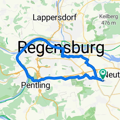
A cycling route starting in Obertraubling, Bavaria, Germany.
Overview
About this route
Tour around TÜP Oberhinkofen, via Wolkering towards Thalmassing to Rauschberg, Köfering, Mangolding, Niedertraubling and back.
Except for a short gravel section, it is always an asphalted side road.
From Wolkering to Thalmassing you have to ride up a small stretch.
- -:--
- Duration
- 19.5 km
- Distance
- 124 m
- Ascent
- 122 m
- Descent
- ---
- Avg. speed
- ---
- Max. altitude

Route highlights
Points of interest along the route
Point of interest after 6.9 km
Wasserschloß Gebelkofen
Point of interest after 10.3 km
Wasserschloß Köfering
Point of interest after 10.7 km
Eisdiele Melisa und Dönerbude
Point of interest after 16.5 km
Biergarten Niedertraubling
Point of interest after 19.4 km
Tourstart beim Gasthaus Stadlerwirt
Continue with Bikemap
Use, edit, or download this cycling route
You would like to ride Piesenkofen Richtung Thalmassing or customize it for your own trip? Here is what you can do with this Bikemap route:
Free features
- Save this route as favorite or in collections
- Copy & plan your own version of this route
- Sync your route with Garmin or Wahoo
Premium features
Free trial for 3 days, or one-time payment. More about Bikemap Premium.
- Navigate this route on iOS & Android
- Export a GPX / KML file of this route
- Create your custom printout (try it for free)
- Download this route for offline navigation
Discover more Premium features.
Get Bikemap PremiumFrom our community
Other popular routes starting in Obertraubling
 Regenpanoramatour
- Distance
- 92.6 km
- Ascent
- 714 m
- Descent
- 711 m
- Location
- Obertraubling, Bavaria, Germany
 DultplatzDonaustauf
- Distance
- 21.8 km
- Ascent
- 260 m
- Descent
- 265 m
- Location
- Obertraubling, Bavaria, Germany
 Abfahrt Pentling,Dom
- Distance
- 27.5 km
- Ascent
- 170 m
- Descent
- 169 m
- Location
- Obertraubling, Bavaria, Germany
 Höflinger Forst - Höhenhof Rundtour
- Distance
- 31.6 km
- Ascent
- 396 m
- Descent
- 400 m
- Location
- Obertraubling, Bavaria, Germany
 2. Welt-Kult-Tour - 175 km - RTF
- Distance
- 172.3 km
- Ascent
- 1,908 m
- Descent
- 1,855 m
- Location
- Obertraubling, Bavaria, Germany
 Quick bike tour through Obertraubling
- Distance
- 7.5 km
- Ascent
- 83 m
- Descent
- 78 m
- Location
- Obertraubling, Bavaria, Germany
 Regenpanoramatour
- Distance
- 92.6 km
- Ascent
- 698 m
- Descent
- 699 m
- Location
- Obertraubling, Bavaria, Germany
 Obertraubling-Matting und zurück
- Distance
- 32.5 km
- Ascent
- 249 m
- Descent
- 242 m
- Location
- Obertraubling, Bavaria, Germany
Open it in the app