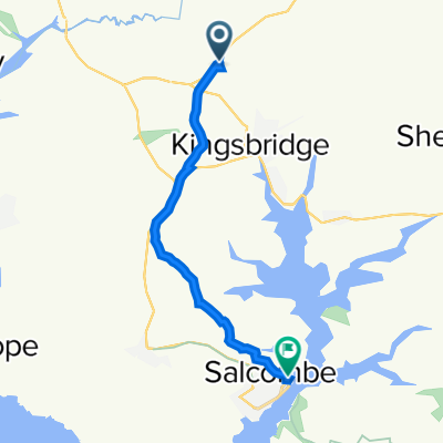
A381, Churchstow, Kingsbridge to 4 The Quay, Dartmouth
A cycling route starting in Kingsbridge, England, United Kingdom.
Overview
About this route
- 1 h 30 min
- Duration
- 21.6 km
- Distance
- 1,363 m
- Ascent
- 1,454 m
- Descent
- 14.4 km/h
- Avg. speed
- ---
- Max. altitude
Route quality
Waytypes & surfaces along the route
Waytypes
Quiet road
10.7 km
(50 %)
Busy road
10 km
(46 %)
Surfaces
Paved
9.8 km
(45 %)
Asphalt
9.8 km
(45 %)
Undefined
11.8 km
(55 %)
Continue with Bikemap
Use, edit, or download this cycling route
You would like to ride A381, Churchstow, Kingsbridge to 4 The Quay, Dartmouth or customize it for your own trip? Here is what you can do with this Bikemap route:
Free features
- Save this route as favorite or in collections
- Copy & plan your own version of this route
- Sync your route with Garmin or Wahoo
Premium features
Free trial for 3 days, or one-time payment. More about Bikemap Premium.
- Navigate this route on iOS & Android
- Export a GPX / KML file of this route
- Create your custom printout (try it for free)
- Download this route for offline navigation
Discover more Premium features.
Get Bikemap PremiumFrom our community
Other popular routes starting in Kingsbridge
- Parkland to Milton Sands
- Distance
- 8.5 km
- Ascent
- 89 m
- Descent
- 188 m
- Location
- Kingsbridge, England, United Kingdom
- Home, KB, Slapton, Torcross, Slapton loop.
- Distance
- 39.7 km
- Ascent
- 799 m
- Descent
- 799 m
- Location
- Kingsbridge, England, United Kingdom
- Relaxed route in United Kingdom
- Distance
- 7.8 km
- Ascent
- 172 m
- Descent
- 145 m
- Location
- Kingsbridge, England, United Kingdom
- Aveton to Salcombe
- Distance
- 13.8 km
- Ascent
- 280 m
- Descent
- 263 m
- Location
- Kingsbridge, England, United Kingdom
- Kingsbridge, Prawle, Slapton 30 miles
- Distance
- 47.7 km
- Ascent
- 721 m
- Descent
- 724 m
- Location
- Kingsbridge, England, United Kingdom
- Route to A381, Churchstow, Kingsbridge
- Distance
- 7.2 km
- Ascent
- 31 m
- Descent
- 93 m
- Location
- Kingsbridge, England, United Kingdom
- Recovered Route
- Distance
- 2.3 km
- Ascent
- 34 m
- Descent
- 74 m
- Location
- Kingsbridge, England, United Kingdom
- A381, Churchstow, Kingsbridge to Station Road, Totnes
- Distance
- 19.5 km
- Ascent
- 301 m
- Descent
- 401 m
- Location
- Kingsbridge, England, United Kingdom
Open it in the app