Kaiserstuhlrunde
- 29.3 km
- 717 m
- 717 m
- Ihringen, Baden-Wurttemberg, Germany
A cycling route starting in Ihringen, Baden-Wurttemberg, Germany.
Overview
Around Totenkopf
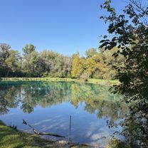
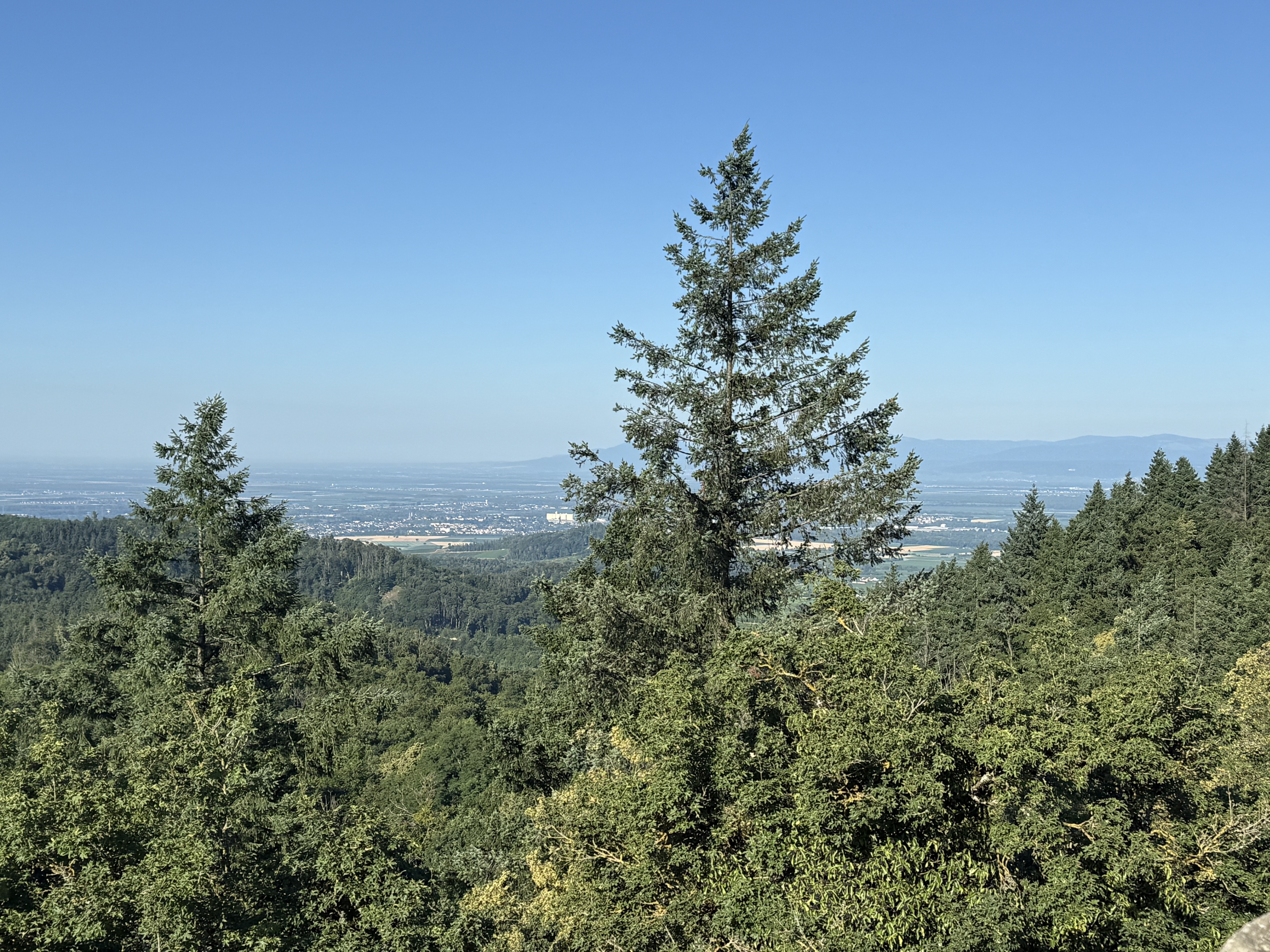
About 2-hour tour (pure riding time without breaks) around Totenkopf with about 26 km and 580 meters of elevation. The ascent is mostly through the forest, making the tour feasible even on hot days. At the turn-around point of the tour, the "Badberg", you have a beautiful view of the inner Kaiserstuhl, the Vosges, and the Black Forest.
After about 3/4 of the route, a small detour (about 10 min with a very steep climb) to Totenkopf is worthwhile. This is rewarding not only on May 1st, when the Black Forest Association OG Ihringen serves refreshments there, but also on days with good visibility. From the tower of the Black Forest Association, there is a splendid panoramic view.
We continue on the marked route back to a fantastic trail to Gierstein and further to the "Katzer"; there you should enjoy the view of Achkarren and Ihringen once more. From now on, it’s all downhill to the starting point in Ihringen at the Kaiserstuhlhalle.
Be careful: when the bell tower of Ihringen is visible from the outskirts, deviate slightly from the marked route and head towards the starting point.
created this 4 years ago
Route quality
Track
20.1 km
44 %
Path
15.1 km
33 %
Paved
20.6 km
(45 %)
Unpaved
21.5 km
(47 %)
Asphalt
18.3 km
40 %
Gravel
10.1 km
22 %
Continue with Bikemap
You would like to ride Rund um den Totenkopf or customize it for your own trip? Here is what you can do with this Bikemap route:
Free trial for 3 days, or one-time payment. More about Bikemap Premium.
Discover more Premium features.
Get Bikemap PremiumFrom our community
Open it in the app