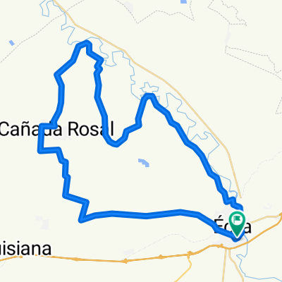
BTT 31-10-2021
A cycling route starting in Écija, Andalusia, Spain.
Overview
About this route
ECIJA - CTRA EL RUBIO - PUESTA EN RIEGO - CTRA MATARREDONDA - MARINALEDA - VEREDA DE RONDA A ECIJA - CAMINO ARRIERO - ECIJA
- -:--
- Duration
- 53.6 km
- Distance
- 384 m
- Ascent
- 385 m
- Descent
- ---
- Avg. speed
- 257 m
- Max. altitude
Route quality
Waytypes & surfaces along the route
Waytypes
Track
34.8 km
(65 %)
Road
5.4 km
(10 %)
Surfaces
Paved
0.5 km
(1 %)
Unpaved
15 km
(28 %)
Gravel
12.9 km
(24 %)
Unpaved (undefined)
2.1 km
(4 %)
Continue with Bikemap
Use, edit, or download this cycling route
You would like to ride BTT 31-10-2021 or customize it for your own trip? Here is what you can do with this Bikemap route:
Free features
- Save this route as favorite or in collections
- Copy & plan your own version of this route
- Sync your route with Garmin or Wahoo
Premium features
Free trial for 3 days, or one-time payment. More about Bikemap Premium.
- Navigate this route on iOS & Android
- Export a GPX / KML file of this route
- Create your custom printout (try it for free)
- Download this route for offline navigation
Discover more Premium features.
Get Bikemap PremiumFrom our community
Other popular routes starting in Écija
Ruta de los aviones- Distance
- 63 km
- Ascent
- 938 m
- Descent
- 935 m
- Location
- Écija, Andalusia, Spain
CX 26 MAR 2016- Distance
- 61.8 km
- Ascent
- 307 m
- Descent
- 304 m
- Location
- Écija, Andalusia, Spain
1 COMBINADA BTT CCCS2017- Distance
- 53.9 km
- Ascent
- 268 m
- Descent
- 276 m
- Location
- Écija, Andalusia, Spain
1 CARRETERA COMBINADA CCCS2017- Distance
- 65.2 km
- Ascent
- 427 m
- Descent
- 434 m
- Location
- Écija, Andalusia, Spain
2 CARRETERA CCCS2017- Distance
- 85.9 km
- Ascent
- 439 m
- Descent
- 440 m
- Location
- Écija, Andalusia, Spain
Etapa 10/05/2015- Distance
- 51.2 km
- Ascent
- 414 m
- Descent
- 415 m
- Location
- Écija, Andalusia, Spain
4 ETAPA BTT CCCS2017- Distance
- 55.5 km
- Ascent
- 375 m
- Descent
- 372 m
- Location
- Écija, Andalusia, Spain
3 BTT CCCS2017- Distance
- 58.6 km
- Ascent
- 407 m
- Descent
- 410 m
- Location
- Écija, Andalusia, Spain
Open it in the app


