

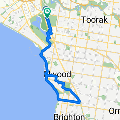
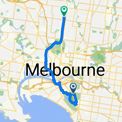
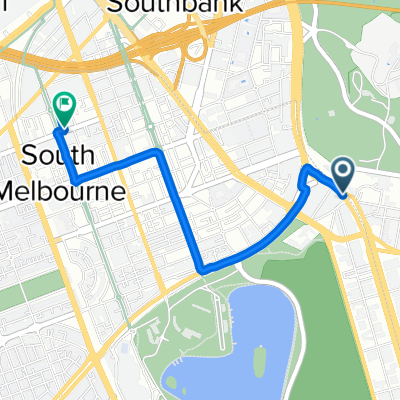
436 St Kilda Road, Melbourne to 551 Whitehorse Road, Surrey Hills
A cycling route starting in South Melbourne, Victoria, Australia.
Overview
About this route
- 46 min
- Duration
- 16.5 km
- Distance
- 184 m
- Ascent
- 102 m
- Descent
- 21.4 km/h
- Avg. speed
- ---
- Max. altitude

Route quality
Waytypes & surfaces along the route
Waytypes
Cycleway
7.6 km
(46 %)
Road
3.5 km
(21 %)
Surfaces
Paved
16 km
(97 %)
Unpaved
0.2 km
(1 %)
Asphalt
8.6 km
(52 %)
Paved (undefined)
5.3 km
(32 %)
Continue with Bikemap
Use, edit, or download this cycling route
You would like to ride 436 St Kilda Road, Melbourne to 551 Whitehorse Road, Surrey Hills or customize it for your own trip? Here is what you can do with this Bikemap route:
Free features
- Save this route as favorite or in collections
- Copy & plan your own version of this route
- Sync your route with Garmin or Wahoo
Premium features
Free trial for 3 days, or one-time payment. More about Bikemap Premium.
- Navigate this route on iOS & Android
- Export a GPX / KML file of this route
- Create your custom printout (try it for free)
- Download this route for offline navigation
Discover more Premium features.
Get Bikemap PremiumFrom our community
Other popular routes starting in South Melbourne
 Machop
- Distance
- 7.8 km
- Ascent
- 52 m
- Descent
- 51 m
- Location
- South Melbourne, Victoria, Australia
 450 to bay return 1hr
- Distance
- 20.1 km
- Ascent
- 209 m
- Descent
- 210 m
- Location
- South Melbourne, Victoria, Australia
 436 St Kilda Road, Melbourne to 551 Whitehorse Road, Surrey Hills
- Distance
- 16.5 km
- Ascent
- 184 m
- Descent
- 102 m
- Location
- South Melbourne, Victoria, Australia
 16.7K to sandy
- Distance
- 16.8 km
- Ascent
- 105 m
- Descent
- 112 m
- Location
- South Melbourne, Victoria, Australia
 From 450 St Kilkda Rd to Jess
- Distance
- 18.1 km
- Ascent
- 159 m
- Descent
- 113 m
- Location
- South Melbourne, Victoria, Australia
 386–410 St Kilda Road, Melbourne à 122 York St, South Melbourne
- Distance
- 2.6 km
- Ascent
- 6 m
- Descent
- 6 m
- Location
- South Melbourne, Victoria, Australia
 Diamond Creek via yarra capital city
- Distance
- 47 km
- Ascent
- 141 m
- Descent
- 106 m
- Location
- South Melbourne, Victoria, Australia
 436 St Kilda Road, Melbourne to 551 Whitehorse Road, Balwyn
- Distance
- 17.5 km
- Ascent
- 9 m
- Descent
- 20 m
- Location
- South Melbourne, Victoria, Australia
Open it in the app