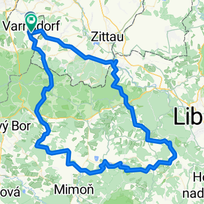
Na Studenec
A cycling route starting in Varnsdorf, Ústecký kraj, Czechia.
Overview
About this route
The route from Studenec to Studený via the blue path is only for the brave and skilled bikers :)
- -:--
- Duration
- 60.5 km
- Distance
- 891 m
- Ascent
- 894 m
- Descent
- ---
- Avg. speed
- ---
- Max. altitude
Route quality
Waytypes & surfaces along the route
Waytypes
Track
24.8 km
(41 %)
Road
12.7 km
(21 %)
Surfaces
Paved
25.4 km
(42 %)
Unpaved
21.2 km
(35 %)
Asphalt
16.3 km
(27 %)
Paved (undefined)
9.1 km
(15 %)
Route highlights
Points of interest along the route
Point of interest after 6.8 km
Křížová cesta v Jiřetíně p. Jedlovou
Point of interest after 22.4 km
Rozhledna Studenec
Continue with Bikemap
Use, edit, or download this cycling route
You would like to ride Na Studenec or customize it for your own trip? Here is what you can do with this Bikemap route:
Free features
- Save this route as favorite or in collections
- Copy & plan your own version of this route
- Sync your route with Garmin or Wahoo
Premium features
Free trial for 3 days, or one-time payment. More about Bikemap Premium.
- Navigate this route on iOS & Android
- Export a GPX / KML file of this route
- Create your custom printout (try it for free)
- Download this route for offline navigation
Discover more Premium features.
Get Bikemap PremiumFrom our community
Other popular routes starting in Varnsdorf
- 2011-07-16 Harthau-Jeschken-Südumfahrung-Bedrichov-Isergebirge
- Distance
- 143.1 km
- Ascent
- 1,785 m
- Descent
- 1,789 m
- Location
- Varnsdorf, Ústecký kraj, Czechia
- Na Děvín
- Distance
- 108.2 km
- Ascent
- 1,049 m
- Descent
- 1,043 m
- Location
- Varnsdorf, Ústecký kraj, Czechia
- Na rozhledny v Německu IV.
- Distance
- 95.2 km
- Ascent
- 571 m
- Descent
- 562 m
- Location
- Varnsdorf, Ústecký kraj, Czechia
- 20170326_140233.gpx
- Distance
- 31 km
- Ascent
- 260 m
- Descent
- 260 m
- Location
- Varnsdorf, Ústecký kraj, Czechia
- Tanečnice přes prameny Mandavy a osadu Kopec
- Distance
- 60.8 km
- Ascent
- 579 m
- Descent
- 579 m
- Location
- Varnsdorf, Ústecký kraj, Czechia
- Na přechody a Královku
- Distance
- 56.1 km
- Ascent
- 389 m
- Descent
- 389 m
- Location
- Varnsdorf, Ústecký kraj, Czechia
- Na rozhledny v Německu II.
- Distance
- 80.8 km
- Ascent
- 823 m
- Descent
- 817 m
- Location
- Varnsdorf, Ústecký kraj, Czechia
- Na Studenec
- Distance
- 60.5 km
- Ascent
- 891 m
- Descent
- 894 m
- Location
- Varnsdorf, Ústecký kraj, Czechia
Open it in the app