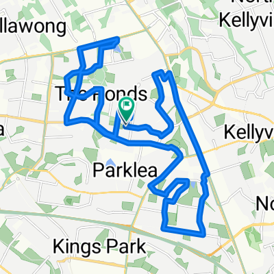
Kellyville-M7-Western Sydney Parkland-loop
A cycling route starting in Stanhope Gardens, New South Wales, Australia.
Overview
About this route
Kellyville - Bella Vista - M7 Cycleway - Western Sydney Parkland - M7 Cycleway - Bella Vista - Kellyville
- -:--
- Duration
- 36.4 km
- Distance
- 224 m
- Ascent
- 224 m
- Descent
- ---
- Avg. speed
- 89 m
- Max. altitude
Route quality
Waytypes & surfaces along the route
Waytypes
Cycleway
36.4 km
(100 %)
Surfaces
Paved
36.1 km
(99 %)
Asphalt
17.5 km
(48 %)
Concrete
11.7 km
(32 %)
Route highlights
Points of interest along the route
Point of interest after 32.9 km
M7 Cycleway start
Point of interest after 36.4 km
Starting point (Kellyville Station)
Continue with Bikemap
Use, edit, or download this cycling route
You would like to ride Kellyville-M7-Western Sydney Parkland-loop or customize it for your own trip? Here is what you can do with this Bikemap route:
Free features
- Save this route as favorite or in collections
- Copy & plan your own version of this route
- Sync your route with Garmin or Wahoo
Premium features
Free trial for 3 days, or one-time payment. More about Bikemap Premium.
- Navigate this route on iOS & Android
- Export a GPX / KML file of this route
- Create your custom printout (try it for free)
- Download this route for offline navigation
Discover more Premium features.
Get Bikemap PremiumFrom our community
Other popular routes starting in Stanhope Gardens
Laurina Way 21, Glenwood to Laurina Way 21, Glenwood- Distance
- 9.8 km
- Ascent
- 0 m
- Descent
- 9 m
- Location
- Stanhope Gardens, New South Wales, Australia
Restful route in Stanhope Gardens- Distance
- 21.3 km
- Ascent
- 149 m
- Descent
- 152 m
- Location
- Stanhope Gardens, New South Wales, Australia
Norwest to Blacktown loop 1- Distance
- 29.7 km
- Ascent
- 293 m
- Descent
- 289 m
- Location
- Stanhope Gardens, New South Wales, Australia
Bella Vista to Rouse Hill Loop- Distance
- 19.7 km
- Ascent
- 181 m
- Descent
- 181 m
- Location
- Stanhope Gardens, New South Wales, Australia
Supersonic route in Windsor- Distance
- 17.7 km
- Ascent
- 112 m
- Descent
- 155 m
- Location
- Stanhope Gardens, New South Wales, Australia
Route to 29 Pennant Way, Castle Hill- Distance
- 131.9 km
- Ascent
- 124 m
- Descent
- 103 m
- Location
- Stanhope Gardens, New South Wales, Australia
Glenwood- Distance
- 11.3 km
- Ascent
- 72 m
- Descent
- 96 m
- Location
- Stanhope Gardens, New South Wales, Australia
Kidman Street 19, Glenwood to Kidman Street 17, Glenwood- Distance
- 11.1 km
- Ascent
- 101 m
- Descent
- 101 m
- Location
- Stanhope Gardens, New South Wales, Australia
Open it in the app

