

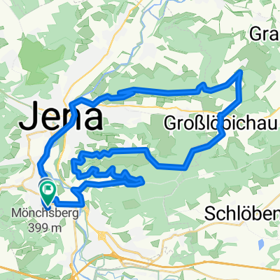
Jena - Kahla
A cycling route starting in Jena, Thuringia, Germany.
Overview
About this route
- -:--
- Duration
- 82.7 km
- Distance
- 738 m
- Ascent
- 597 m
- Descent
- ---
- Avg. speed
- 423 m
- Max. altitude

Route quality
Waytypes & surfaces along the route
Waytypes
Busy road
42.3 km
(51 %)
Quiet road
17.1 km
(21 %)
Surfaces
Paved
62.2 km
(75 %)
Unpaved
0.7 km
(<1 %)
Asphalt
60.5 km
(73 %)
Paving stones
1.1 km
(1 %)
Continue with Bikemap
Use, edit, or download this cycling route
You would like to ride Jena - Kahla or customize it for your own trip? Here is what you can do with this Bikemap route:
Free features
- Save this route as favorite or in collections
- Copy & plan your own version of this route
- Split it into stages to create a multi-day tour
- Sync your route with Garmin or Wahoo
Premium features
Free trial for 3 days, or one-time payment. More about Bikemap Premium.
- Navigate this route on iOS & Android
- Export a GPX / KML file of this route
- Create your custom printout (try it for free)
- Download this route for offline navigation
Discover more Premium features.
Get Bikemap PremiumFrom our community
Other popular routes starting in Jena
 Jena-Stadtroda-Jena
- Distance
- 34.6 km
- Ascent
- 280 m
- Descent
- 251 m
- Location
- Jena, Thuringia, Germany
 : Halbtagestour mit Kindern
- Distance
- 29.6 km
- Ascent
- 185 m
- Descent
- 201 m
- Location
- Jena, Thuringia, Germany
 Jena - Leuchtenburg/St. Ganloff
- Distance
- 91.1 km
- Ascent
- 585 m
- Descent
- 585 m
- Location
- Jena, Thuringia, Germany
 Trainingsrunde
- Distance
- 34.9 km
- Ascent
- 559 m
- Descent
- 558 m
- Location
- Jena, Thuringia, Germany
 Feierabendrunde TPA
- Distance
- 38.5 km
- Ascent
- 443 m
- Descent
- 437 m
- Location
- Jena, Thuringia, Germany
 Klein aber Fein
- Distance
- 32.9 km
- Ascent
- 335 m
- Descent
- 293 m
- Location
- Jena, Thuringia, Germany
 Hohenwarte-Runde
- Distance
- 171.3 km
- Ascent
- 2,292 m
- Descent
- 2,253 m
- Location
- Jena, Thuringia, Germany
 Jena - Stausee Hohenfelden - Kunitzburg - Jena CLONED FROM ROUTE 1736593
- Distance
- 109.9 km
- Ascent
- 623 m
- Descent
- 623 m
- Location
- Jena, Thuringia, Germany
Open it in the app