

Rheinischer Esel-Wannebachtal-Hengstey-und Harkort See- Witten
A cycling route starting in Witten, North Rhine-Westphalia, Germany.
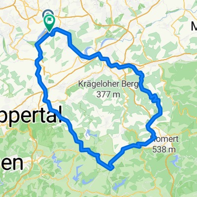
Overview
About this route
Die Route war zwischen Löttringhausen und dem Wannebachtal nicht einfach zu befahren. Viele unbefestigte Waldwege mit zum Teil umgestürzten Bäumen machten die Fahrt zu einem Hindernisrennen. Anschließend eine wundervolle Weiterfahrt.
- 3 h 17 min
- Duration
- 49.4 km
- Distance
- 298 m
- Ascent
- 249 m
- Descent
- 15 km/h
- Avg. speed
- 235 m
- Max. altitude
Route photos

Route quality
Waytypes & surfaces along the route
Waytypes
Path
17.4 km
(35 %)
Quiet road
11.4 km
(23 %)
Surfaces
Paved
39.7 km
(81 %)
Unpaved
7.6 km
(15 %)
Asphalt
34.9 km
(71 %)
Gravel
5.3 km
(11 %)
Continue with Bikemap
Use, edit, or download this cycling route
You would like to ride Rheinischer Esel-Wannebachtal-Hengstey-und Harkort See- Witten or customize it for your own trip? Here is what you can do with this Bikemap route:
Free features
- Save this route as favorite or in collections
- Copy & plan your own version of this route
- Sync your route with Garmin or Wahoo
Premium features
Free trial for 3 days, or one-time payment. More about Bikemap Premium.
- Navigate this route on iOS & Android
- Export a GPX / KML file of this route
- Create your custom printout (try it for free)
- Download this route for offline navigation
Discover more Premium features.
Get Bikemap PremiumFrom our community
Other popular routes starting in Witten
 Mountainbike 1
- Distance
- 32.1 km
- Ascent
- 232 m
- Descent
- 230 m
- Location
- Witten, North Rhine-Westphalia, Germany
 Do-Oespel - Sprockhövel - Do-Oespel
- Distance
- 45.7 km
- Ascent
- 344 m
- Descent
- 344 m
- Location
- Witten, North Rhine-Westphalia, Germany
 Kleine Ruhrrunde
- Distance
- 52.5 km
- Ascent
- 350 m
- Descent
- 362 m
- Location
- Witten, North Rhine-Westphalia, Germany
 Lahmen Hasen V3
- Distance
- 109.4 km
- Ascent
- 842 m
- Descent
- 841 m
- Location
- Witten, North Rhine-Westphalia, Germany
 ketteimmerrechts.de // kir-ig.de
- Distance
- 49.7 km
- Ascent
- 455 m
- Descent
- 458 m
- Location
- Witten, North Rhine-Westphalia, Germany
 Rundkurs ums Autobahnkreuz Do-West
- Distance
- 19.9 km
- Ascent
- 93 m
- Descent
- 94 m
- Location
- Witten, North Rhine-Westphalia, Germany
 Wittentrails
- Distance
- 18.5 km
- Ascent
- 329 m
- Descent
- 329 m
- Location
- Witten, North Rhine-Westphalia, Germany
 18.10.2008 Matal Motion Bike Freunde Herbede
- Distance
- 38.2 km
- Ascent
- 363 m
- Descent
- 360 m
- Location
- Witten, North Rhine-Westphalia, Germany
Open it in the app