

Rafting Camp Kalista
- Location
- Bosnia and Herzegovina
- Time on Bikemap
- Member since 12/2/2015
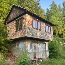
Kalista Camp (greek καλλίστη, kallístê = "the most beautiful") has been operating since 1998. It was the first camp in today’s rafting centre ‘Bastasi’ established by the three enthusiastic pioneers and good friends Mićko, Boban and Vito, who run the camp still today. They had a marvellous vision and luck to be the first to choose so that they chose the most attractive and best position in the rafting centre (the name of the camp speaks for itself). The camp stands on the right bank of the river Tara, surrounded by unspoiled nature.
More about us: http://www.rafting-tara-kalista.com
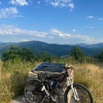
My routes
Planned and recorded rides

Discover
My most popular routes

Crkvicko Polje - Kamp Kalista Var. 2
Cycling route in Plužine, Opština Plužine, Montenegro
- 42.1 km
- Distance
- 672 m
- Ascent
- 1,341 m
- Descent

Crkvicko Polje - Kamp Kalista Var. 3
Cycling route in Plužine, Opština Plužine, Montenegro
- 54.5 km
- Distance
- 802 m
- Ascent
- 1,470 m
- Descent

Crkvicko Polje - Kamp Kalista Var. 1
Cycling route in Plužine, Opština Plužine, Montenegro
- 39.6 km
- Distance
- 597 m
- Ascent
- 1,266 m
- Descent

Zelengora MTB 01
Cycling route in Foča, Republika Srpska, Bosnia and Herzegovina
- 49.2 km
- Distance
- 1,463 m
- Ascent
- 1,481 m
- Descent
More routes from Bosnia and Herzegovina
 Goražde-Glamoč-Mirvići (Kahva)-Berič-Goražde
- Distance
- 13.8 km
- Ascent
- 623 m
- Descent
- 297 m
- Location
- Goražde, Federation of Bosnia and Herzegovina, Bosnia and Herzegovina
 NASTAVAK RUTE Goražde-Glamoč-Mirvići (Kahva)-Berič-Goražde
- Distance
- 6.2 km
- Ascent
- 7 m
- Descent
- 367 m
- Location
- Goražde, Federation of Bosnia and Herzegovina, Bosnia and Herzegovina
 Nevjestina, Sarajevo to Dariva, Sarajevo
- Distance
- 24.9 km
- Ascent
- 439 m
- Descent
- 452 m
- Location
- Kobilja Glava, Federation of Bosnia and Herzegovina, Bosnia and Herzegovina
 GMJV+95H to Mehmedalije Maka Dizdara
- Distance
- 10.8 km
- Ascent
- 58 m
- Descent
- 101 m
- Location
- Tuzla, Federation of Bosnia and Herzegovina, Bosnia and Herzegovina
 Gemütliche Fahrt
- Distance
- 53.2 km
- Ascent
- 588 m
- Descent
- 638 m
- Location
- Cazin, Federation of Bosnia and Herzegovina, Bosnia and Herzegovina
 Goražde-Spomenik-Gorazde
- Distance
- 13.5 km
- Ascent
- 393 m
- Descent
- 395 m
- Location
- Goražde, Federation of Bosnia and Herzegovina, Bosnia and Herzegovina