Olbrzymy - B艂otnik + Po艣wit
A cycling route starting in Podg贸rzyn, Lower Silesian Voivodeship, Poland.
Overview
About this route
- -:--
- Duration
- 13.6 km
- Distance
- 287 m
- Ascent
- 286 m
- Descent
- ---
- Avg. speed
- 762 m
- Max. altitude
Route quality
Waytypes & surfaces along the route
Waytypes
Cycleway
8.9 km
(66 %)
Quiet road
2.7 km
(20 %)
Surfaces
Paved
3.2 km
(24 %)
Unpaved
1.2 km
(9 %)
Asphalt
3.1 km
(23 %)
Ground
1.1 km
(8 %)
Continue with Bikemap
Use, edit, or download this cycling route
You would like to ride Olbrzymy - B艂otnik + Po艣wit or customize it for your own trip? Here is what you can do with this Bikemap route:
Free features
- Save this route as favorite or in collections
- Copy & plan your own version of this route
- Sync your route with Garmin or Wahoo
Premium features
Free trial for 3 days, or one-time payment. More about Bikemap Premium.
- Navigate this route on iOS & Android
- Export a GPX / KML file of this route
- Create your custom printout (try it for free)
- Download this route for offline navigation
Discover more Premium features.
Get Bikemap PremiumFrom our community
Other popular routes starting in Podg贸rzyn
- 09.09.2020 SINGLE Olbrzymy
- Distance
- 22.2 km
- Ascent
- 310 m
- Descent
- 309 m
- Location
- Podg贸rzyn, Lower Silesian Voivodeship, Poland
- Przesieka-P艡eseka 2018
- Distance
- 332.2 km
- Ascent
- 1,479 m
- Descent
- 1,577 m
- Location
- Podg贸rzyn, Lower Silesian Voivodeship, Poland
- prze艂ecz karkonoska
- Distance
- 9.4 km
- Ascent
- 774 m
- Descent
- 34 m
- Location
- Podg贸rzyn, Lower Silesian Voivodeship, Poland
- Mushrooming trip in Karkonosze Mts
- Distance
- 19.4 km
- Ascent
- 507 m
- Descent
- 507 m
- Location
- Podg贸rzyn, Lower Silesian Voivodeship, Poland
- AMP Przesieka dzie艅 pierwszy
- Distance
- 12.9 km
- Ascent
- 350 m
- Descent
- 350 m
- Location
- Podg贸rzyn, Lower Silesian Voivodeship, Poland
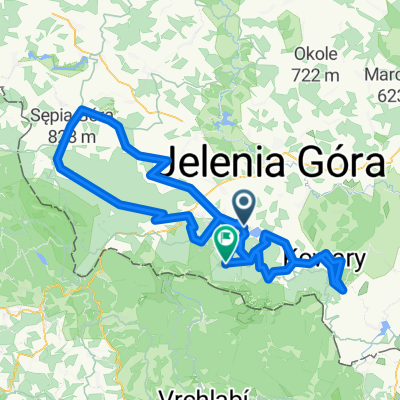
- 07.04.19 Lucni Bouda
- Distance
- 27.7 km
- Ascent
- 1,470 m
- Descent
- 1,351 m
- Location
- Podg贸rzyn, Lower Silesian Voivodeship, Poland
- Krkono拧sk谩 pivn铆 stezka 2018
- Distance
- 31.3 km
- Ascent
- 612 m
- Descent
- 1,326 m
- Location
- Podg贸rzyn, Lower Silesian Voivodeship, Poland
- Riesengebirge Tag 3
- Distance
- 248.6 km
- Ascent
- 3,617 m
- Descent
- 4,662 m
- Location
- Podg贸rzyn, Lower Silesian Voivodeship, Poland
Open it in the app