
My saved routes
A collection of 18 cycling routes, created by chrris.
Overview
About this collection
This collection contains all routes that were previously saved.
- 18
- Routes
- -:--
- Duration
- 645.3 km
- Distance
- ---
- Avg. speed
- 20,944 m
- Ascent
- 20,945 m
- Descent
created this 9 years ago
My saved routes
Routes in this collection
All 18 routes in this collection can be opened on the map or in the Bikemap App for more details, where you can adjust them in the route planner, or download them as GPX or KML file. Use them as a template for planning your own rides, or let Bikemap navigate you along them directly.

Rund um den Priedröf
Cycling route in Kleinkirchheim, Carinthia, Austria
- 31.6 km
- Distance
- 1,193 m
- Ascent
- 1,193 m
- Descent
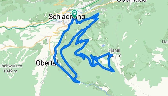
Schladming - 02 Planai Runde
Cycling route in Schladming, Styria, Austria
- 32.3 km
- Distance
- 1,109 m
- Ascent
- 1,109 m
- Descent

Schladming - 01Ramsau-Rund
Cycling route in Schladming, Styria, Austria
- 38.1 km
- Distance
- 1,190 m
- Ascent
- 1,190 m
- Descent

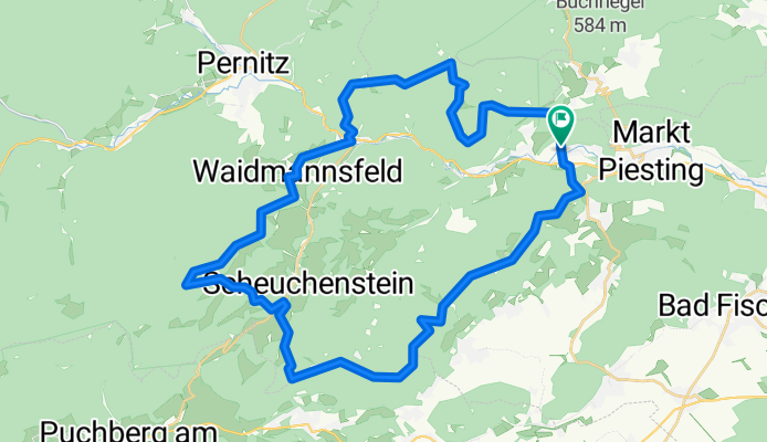
MPiesting - VordereMandling - Waidmannsf - Plattenst - HoheWand - MPiesting
Cycling route in Hernstein, Lower Austria, Austria
- 45.9 km
- Distance
- 2,206 m
- Ascent
- 2,206 m
- Descent

GK Schneebergrunde
Cycling route in Puchberg am Schneeberg, Lower Austria, Austria
- 30.4 km
- Distance
- 893 m
- Ascent
- 893 m
- Descent

Puchberg - Schneeberg - Puchberg
Cycling route in Puchberg am Schneeberg, Lower Austria, Austria
- 33.1 km
- Distance
- 1,806 m
- Ascent
- 1,806 m
- Descent

Schneeberg
Cycling route in Puchberg am Schneeberg, Lower Austria, Austria
- 32.9 km
- Distance
- 845 m
- Ascent
- 844 m
- Descent

flatzer wand runde
Cycling route in Neunkirchen, Lower Austria, Austria
- 24.1 km
- Distance
- 366 m
- Ascent
- 365 m
- Descent

Pottenstein Wolfgeist-Strecke
Cycling route in Pottenstein, Lower Austria, Austria
- 32.8 km
- Distance
- 685 m
- Ascent
- 685 m
- Descent

Lindkogelstrecke+VöslauerHütte
Cycling route in Bad Vöslau, Lower Austria, Austria
- 27.8 km
- Distance
- 816 m
- Ascent
- 816 m
- Descent

Lindkogel-Raiffeisentrail-Harzberg-Customtrail
Cycling route in Bad Vöslau, Lower Austria, Austria
- 43.8 km
- Distance
- 1,352 m
- Ascent
- 1,352 m
- Descent