Bild_Bike

Bild_Bike

A collection of 9 cycling routes, created by ANDREAS HASELGRÜBLER.

Overview

About this collection

This route collection contains 9 cycling routes with a total length of 799.3 km.

9
Routes
-:--
Duration
799.3 km
Distance
---
Avg. speed
9,638 m
Ascent
9,794 m
Descent
ANDREAS HASELGRÜBLER

created this 4 years ago

Bild_Bike

Routes in this collection

All 9 routes in this collection can be opened on the map or in the Bikemap App for more details, where you can adjust them in the route planner, or download them as GPX or KML file. Use them as a template for planning your own rides, or let Bikemap navigate you along them directly.

Im Erzgebirge: Von Gipfel zu Gipfel Teil 2

Cycling route in Rittersgrün, Saxony, Germany

Nach Rittersgrün erreicht man auf tschechischem Gebiet die Halbmeiler Wiesen. Anschließend wechselt die Route zurück nach Deutschland zum Rabenberg. Auf Trails rollt es hinab bis Erlabrunn. Nach dem Auersberg wird das Hochmoor Kleiner Kranichsee passiert und der Gipfel des Plattenbe…
93.6 km
Distance
2,807 m
Ascent
2,540 m
Descent

Im Erzgebirge: Von Gipfel zu Gipfel Teil 1

Cycling route in Oberwiesenthal, Saxony, Germany

In Oberwiesenthal geht es los. Bei Niederschlag queren die Schienen der Fichtelbergbahn die Route. Die Strecke führt etwas südlich an der TalsperreCranzahl vorbei, bis der Anstieg zum Bärenstein folgt. Danach erreicht man die Basaltsäulen am Pöhlberg bei Annaberg-Buchholz u…
69.4 km
Distance
1,843 m
Ascent
2,030 m
Descent

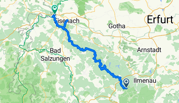
Rennsteig-Radwanderweg Teil 2

Cycling route in Gehlberg, Thuringia, Germany

Die Wetterstation Schmücke stellt mit 942 Höhenmetern den höchsten Punkt des Rennsteigs dar. Die nächste größere Stadt ist der Wintersportort Oberhof. Ab hier führt der Weg fast ausschließlich durch die Natur. Die Alte Ausspanne bietet sich zur ersten Rast …
96.3 km
Distance
1,851 m
Ascent
2,575 m
Descent

Rennsteig-Radwanderweg Teil 1

Cycling route in Blankenstein, Thuringia, Germany

Startpunkt ist Blankenstein an der Mündung der Selbitz in die Saale. Bis auf Höhe des Kulmbergs geht’s bergauf. Hier wird der Höhenweg erreicht. In Lehesten radelt es sich entspannt an den mit dem Schiefer der Region eingedeckten Häusern vorbei. Steinbach am Wald kennzeich…
108.7 km
Distance
2,008 m
Ascent
1,517 m
Descent

Spreewald Route 1

Cycling route in Neu Zauche, Brandenburg, Germany

Von Alt Zauche-Wußwerk führt der Weg auf die L 44. Dieser bis nach Lübben folgen. Hier muss auf der 87 abgebogen werden bis zum Abzweig auf die L 42. Fast schnurgerade führt diese Strecke nach Schlepzig. Vor der Spree wird links in die Dammstraße abgebogen, dann radelt ma…
46.1 km
Distance
104 m
Ascent
106 m
Descent

Spreewald Route 2

Cycling route in Neu Zauche, Brandenburg, Germany

The route follows a section of the Nordumfluter, turns right, runs along the Neue Polenzóa and canal 9/10, until the Große Fließ is crossed. After the Burg-Lübben canal, Wotschofska is reached. Following the Rollkanal, the Kleine Kossa and the Spree, you arrive at Lübbenau. Then follow the signpost…
55.3 km
Distance
160 m
Ascent
161 m
Descent

Berliner Mauerweg

Cycling route in Tiergarten, State of Berlin, Germany

162.4 km
Distance
196 m
Ascent
195 m
Descent

Dom zu Eichstätt über Ingolstadt bis Wallheim und zurück

Cycling route in Eichstätt, Bavaria, Germany

On paved cycling paths, you go from the cathedral in Eichstätt to the climbing rock in front of Dollnstein. After some climbs towards Rennertshofen, you reach Neuburg, which looks medieval. Along the Danube, you head to Ingolstadt and after another one and a half hours, you return to Eichstätt.
100.1 km
Distance
347 m
Ascent
347 m
Descent

Dom zu Eichstätt bis Pfünz und zurück über Wellheim

Cycling route in Eichstätt, Bavaria, Germany

From Eichstätt, the route goes to Pfünz along Roman traces, still visible in many places. The geological background of the route is also described on information boards. After Pfünz, you ride quiet roads through forests to Hitzhofen/Oberzell, where on clear days there is a nice view towards Ingolst…
67.5 km
Distance
322 m
Ascent
323 m
Descent