RegioGrün South Cycle Route
RegioGrün Adventure Route South

RegioGrün South Cycle Route

A collection of 6 cycling routes.
OverviewAbout this collection

A relaxed spin along the southern stretch of the RegioGrün network, linking green spaces, fields, and quiet neighborhoods. The route is roughly 23 km with about 100 m of gentle climbing—rolling and easy in either direction.

Terrain is mixed: plenty of farm tracks and paths, a good share of quiet roads, and only a blink of busier road. Surfaces are mostly paved, with around 3 km of gravel. It rides fine on a city or touring bike; wider tires (32–40 mm) are nice if it’s wet.

There’s no fixed start or finish—just hop on wherever it’s convenient and follow the green corridors south. Expect calm sections through parks and farmland, short links on local streets, and the occasional shared path where you’ll meet walkers.

Good for an easy half‑day outing, families, or anyone wanting traffic‑light scenery without big climbs. Pack water and snacks; there are plenty of spots to pause for a break. Keep an eye out for uneven patches on the gravel sections and yield on shared paths.

Ride it as a point‑to‑point or connect it with nearby lanes to make your own loop.

6
Routes
-:--
Duration
25.9 km
Distance
---
Avg. speed
95 m
Ascent
108 m
Descent
RegioGrün South Cycle RouteRoutes in this collection
All 6 routes in this collection can be opened on the map or in the Bikemap App for more details, where you can adjust them in the route planner, or download them as GPX or KML file. Use them as a template for planning your own rides, or let Bikemap navigate you along them directly.
Alfter Vorgebirgsbahnweg (71) - Bonn Botanischer Garten (73)
Official
Alfter Vorgebirgsbahnweg (71) - Bonn Botanischer Garten (73)

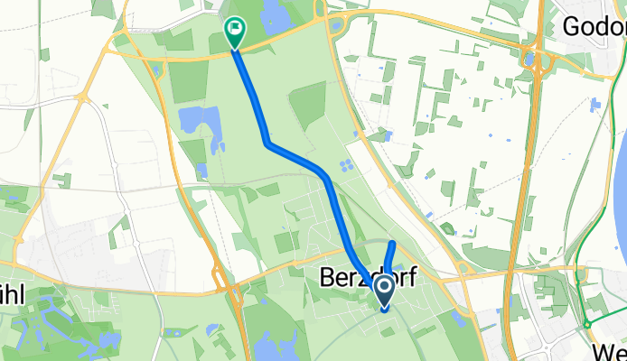
Cycling route in Alfter, North Rhine-Westphalia, Germany

Short, flat hop from Alfter to Bonn’s Botanical Garden. Roll mostly on paved, quiet roads and farm tracks with barely any climb. Start on the Vorgebirgsbahnweg in Alfter and cruise into Bonn, finishing by the gardens at Poppelsdorf Palace. Easy, family-friendly, and green the whole way. About 5.6 k…
5.6 km
Distance
18 m
Ascent
20 m
Descent
Bornheim (03) - Bornheim (11)
Official
Bornheim (03) - Bornheim (11)

Cycling route in Bornheim, North Rhine-Westphalia, Germany

Short, flat hop across Bornheim on the RegioGrün Erlebnisroute Süd. About 2.3 km on smooth asphalt farm tracks, with a tiny downhill and open fields for views. Perfect as a connector from section 03 to 11 or a relaxed family spin. Expect orchards and strawberry fields—classic Bornheim. Easy, paved,…
2.3 km
Distance
0 m
Ascent
9 m
Descent
Niederkassel - Wesseling
Official
Niederkassel - Wesseling

Cycling route in Niederkassel, North Rhine-Westphalia, Germany

Easy spin from Niederkassel to Wesseling on the RegioGrün Erlebnisroute Süd. Around 3.8 km, almost flat, on mostly paved paths and quiet tracks, so it’s relaxed and beginner-friendly. Start by the Rhine in Niederkassel, cruise through green spaces, then roll into Wesseling for a look at the river p…
3.8 km
Distance
11 m
Ascent
7 m
Descent
Brühl – Wesseling
Official
Brühl – Wesseling

Cycling route in Brühl, North Rhine-Westphalia, Germany

A short, flat hop on the RegioGrün Erlebnisroute Süd from Brühl to Wesseling. Roll out from Brühl’s castle town, cruise mostly on smooth asphalt and quiet roads, and finish in Rhine-side Wesseling. Perfect as a connector or an easy spin—about 3.5 km with barely any climbing. Great for any bike.
3.5 km
Distance
13 m
Ascent
16 m
Descent
Bayenthal (Köln) – Brühl
Official
Bayenthal (Köln) – Brühl

Cycling route in Bayenthal, North Rhine-Westphalia, Germany

Roll out from Cologne’s Bayenthal by the Rhine and cruise south to Brühl on the RegioGrün Erlebnisroute Süd. It’s about 8 km, mostly flat, with a mix of paved sections and gravel paths through green spaces and quiet streets. Expect tracks and park paths more than busy roads, so wider tires are hand…
8.3 km
Distance
44 m
Ascent
41 m
Descent
Köln: Bayenthal – Neustadt/Süd
Official
Köln: Bayenthal – Neustadt/Süd

Cycling route in Bayenthal, North Rhine-Westphalia, Germany

Quick city spin along the Rhine from Bayenthal up to Neustadt/Süd. About 2.4 km and mostly flat, perfect for an easy roll to cafés, parks, and the Volksgarten area. Expect riverside vibes and calm streets, finishing near lively Südstadt hangouts—nice as part of the RegioGrün Erlebnisroute Süd or a …
2.4 km
Distance
9 m
Ascent
15 m
Descent