
Europaradweg R1
A cycling tour with 13 stages, starting in Tiergarten, State of Berlin, Germany.
Overview
About this tour
This cycling tour has 13 stages and a total length of 1,037.1 km.
- 13
- Routes
- 61 h 22 min
- Duration
- 1,037.1 km
- Distance
- 16.9 km/h
- Avg. speed
- 673 m
- Ascent
- 707 m
- Descent

created this 5 months ago
Europaradweg R1
Stages of this tour
All 13 stages of this tour can be opened on the map or in the Bikemap App for more details, where you can adjust them in the route planner or download them as GPX or KML file. Use them as a template for planning your own tour, or let Bikemap navigate you along them directly.
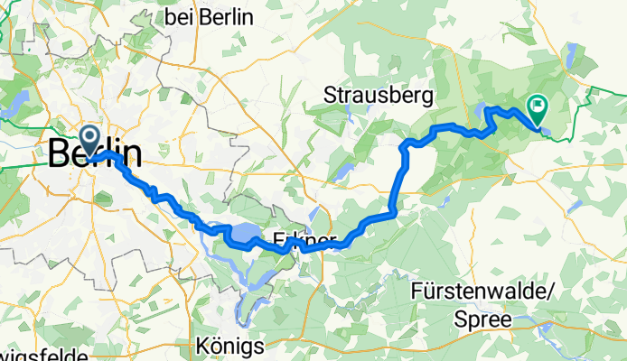
Tiergarten - Müncheberg
Cycling route in Tiergarten, State of Berlin, Germany
- 79.8 km
- Distance
- 18 m
- Ascent
- 4 m
- Descent
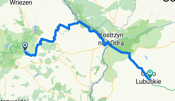
Müncheberg - Ośno Lubuskie
Cycling route in Müncheberg, Brandenburg, Germany
- 77.7 km
- Distance
- 71 m
- Ascent
- 57 m
- Descent
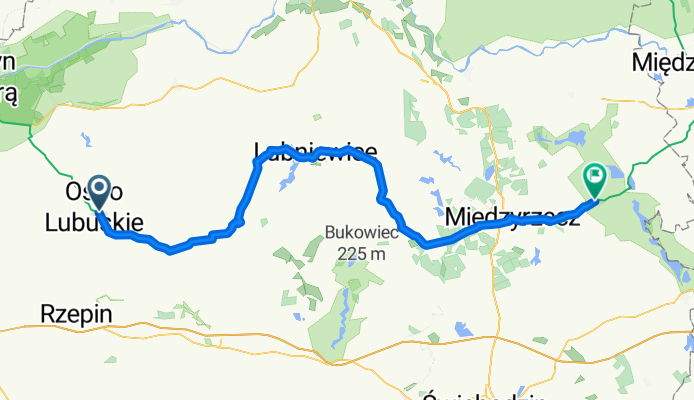
Ośno Lubuskie - Pszczew
Cycling route in Ośno Lubuskie, Lubusz Voivodship, Poland
- 76.1 km
- Distance
- 116 m
- Ascent
- 131 m
- Descent
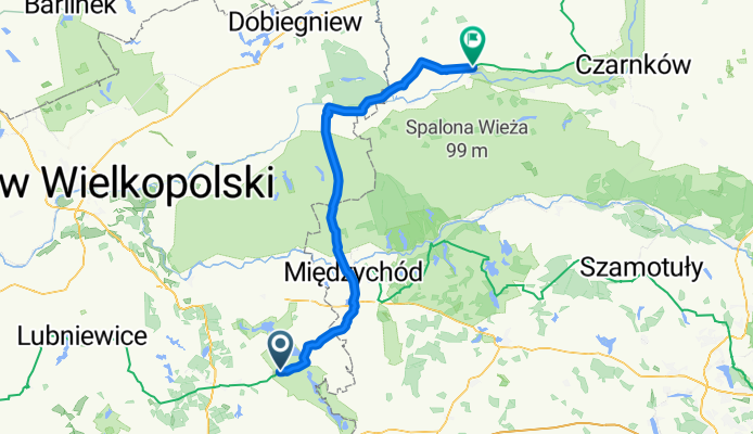
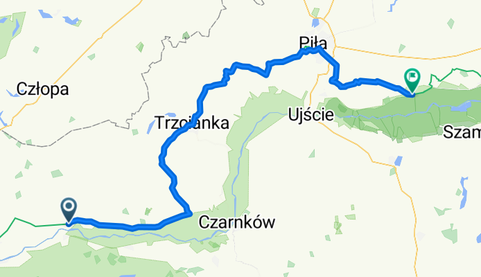
Pszczew - Wieleń
Cycling route in Pszczew, Lubusz Voivodship, Poland
- 80 km
- Distance
- 21 m
- Ascent
- 27 m
- Descent
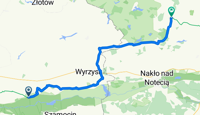
Wieleń - Miasteczko Krajeńskie
Cycling route in Wieleń, Greater Poland Voivodeship, Poland
- 86.5 km
- Distance
- 87 m
- Ascent
- 43 m
- Descent
Miasteczko Krajeńskie - Sośno
Cycling route in Miasteczko Krajeńskie, Greater Poland Voivodeship, Poland
- 72.6 km
- Distance
- 57 m
- Ascent
- 27 m
- Descent
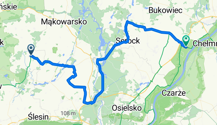
Sośno - Chełmno
Cycling route in Sośno, Kujawsko-Pomorskie Voivodship, Poland
- 81.5 km
- Distance
- 16 m
- Ascent
- 109 m
- Descent
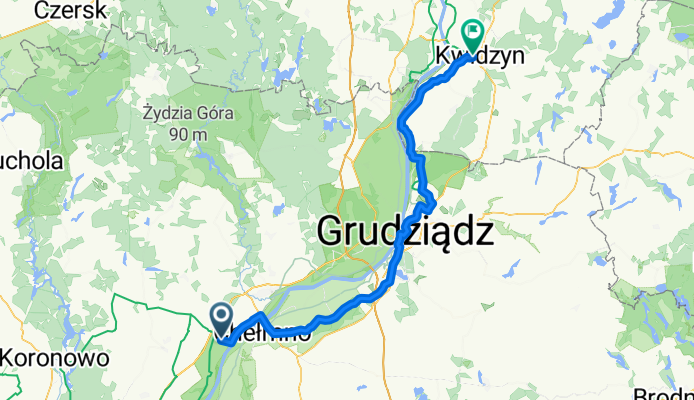
Chełmno - Kwidzyn
Cycling route in Chełmno, Kujawsko-Pomorskie Voivodship, Poland
- 80.9 km
- Distance
- 0 m
- Ascent
- 16 m
- Descent
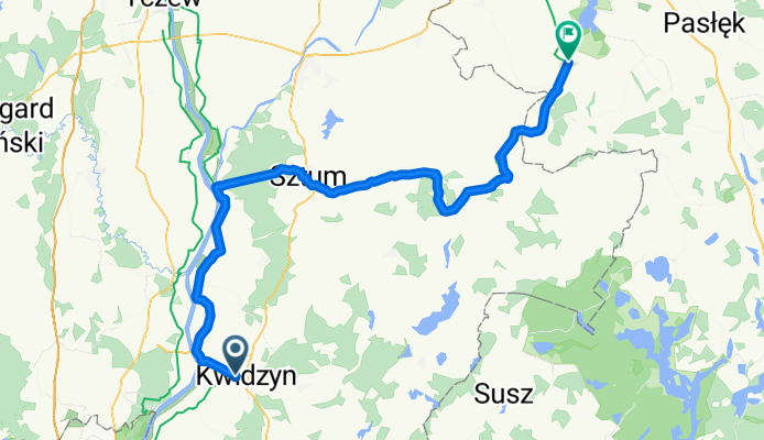
Kwidzyn - Gronowo Elbląskie
Cycling route in Kwidzyn, Pomeranian Voivodeship, Poland
- 78.9 km
- Distance
- 73 m
- Ascent
- 84 m
- Descent
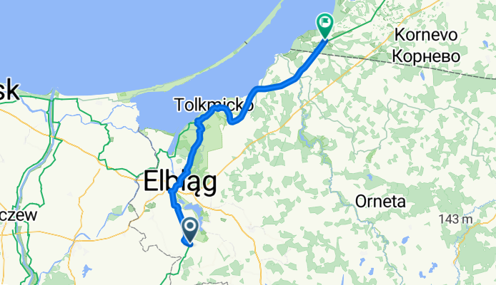
Gronowo Elbląskie - Mamonovo
Cycling route in Gronowo Elbląskie, Warmian-Masurian Voivodeship, Poland
- 78.8 km
- Distance
- 156 m
- Ascent
- 126 m
- Descent
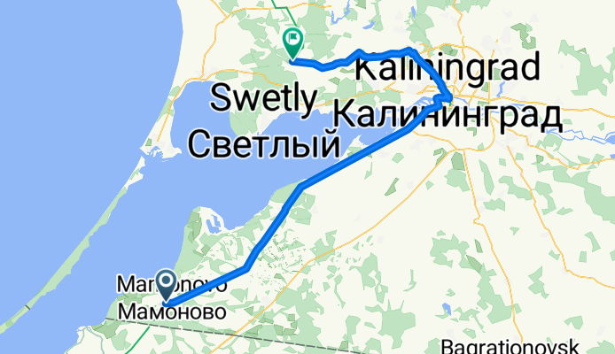
Mamonovo - Volochayevskoye
Cycling route in Mamonovo, Kaliningrad Oblast, Russia
- 75.3 km
- Distance
- 58 m
- Ascent
- 46 m
- Descent
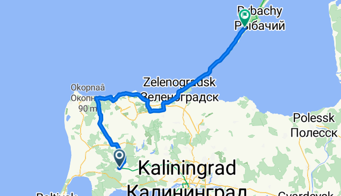
Volochayevskoye
- 88.8 km
- Distance
- 0 m
- Ascent
- 37 m
- Descent