For your road bike
Ride the world's best road cycling routes
From legendary alpine passes to rolling coastal highways—these are the top-rated road bike routes from the Bikemap community. Get inspired and ride your perfect line.
 2024-01-27 15:48 GMT+1 Mittlerer Ring
- Distance
- 40.5 km
- Ascent
- 205 m
- Descent
- 201 m
- Location
- Munich, Bavaria, Germany
 Trieste - Buje
- Distance
- 64.3 km
- Ascent
- 762 m
- Descent
- 626 m
- Location
- Trieste, Friuli Venezia Giulia, Italy
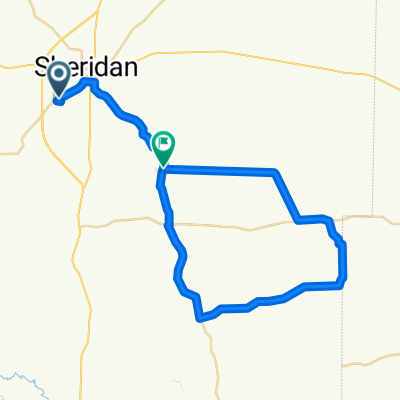 Arky Gravel
- Distance
- 50.5 km
- Ascent
- 336 m
- Descent
- 341 m
- Location
- Sheridan, Arkansas, United States
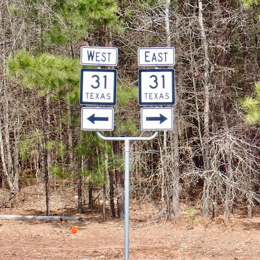 Tyler to Kilgore
- Distance
- 54 km
- Ascent
- 514 m
- Descent
- 556 m
- Location
- Tyler, Texas, United States
 Canada Day Centurion
- Distance
- 100.2 km
- Ascent
- 749 m
- Descent
- 758 m
- Location
- West End, British Columbia, Canada
 SE - Fish creek & Glenmore Loop
- Distance
- 82.3 km
- Ascent
- 465 m
- Descent
- 464 m
- Location
- Calgary, Alberta, Canada
 Día 5
Día 5- Distance
- 32.6 km
- Ascent
- 214 m
- Descent
- 218 m
- Location
- Godoy Cruz, Mendoza Province, Argentina
 Ruta L-751, Retiro a Ruta L-751, Retiro
- Distance
- 64.3 km
- Ascent
- 494 m
- Descent
- 483 m
- Location
- Parral, Maule Region, Chile
 Picton ferry to Nelson Lakes Tour Aotearoa
- Distance
- 115.1 km
- Ascent
- 1,663 m
- Descent
- 1,219 m
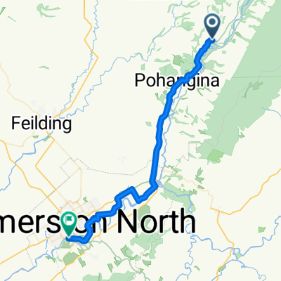 Pohangina Valley to Palmerston North — Tour Aotearoa
- Distance
- 46.1 km
- Ascent
- 341 m
- Descent
- 484 m
 Family-Friendly E-Bike Journey from Coolum Beach to Cotton Tree
- Distance
- 48 km
- Ascent
- 192 m
- Descent
- 192 m
- Location
- Coolum Beach, Queensland, Australia
 Sunshine Coast Scenic Cycle Loop: Moffat Beach, Point Cartwright & Mooloola River Canals
- Distance
- 40.4 km
- Ascent
- 81 m
- Descent
- 127 m
- Location
- Mooloolabah, Queensland, Australia
 full nt bike paths
- Distance
- 63.2 km
- Ascent
- 571 m
- Descent
- 570 m
- Location
- Sai Kung, Sai Kung District, Hong Kong
 잠실철교 - 행주대교
- Distance
- 33.4 km
- Ascent
- 204 m
- Descent
- 213 m
- Location
- Guri-si, Gyeonggi-do, South Korea
- Route to Hosdurg Fort
- Distance
- 41.7 km
- Ascent
- 380 m
- Descent
- 384 m
- Location
- Kāsaragod, Kerala, India
 Route nach Azhikode Road, Azhikode North, Kannur 670009, Kerala
- Distance
- 34.9 km
- Ascent
- 318 m
- Descent
- 298 m
- Location
- Tellicherry, Kerala, India
 Uganda-Ruanda Etappe 8 (Ruhanga-Kabale)
- Distance
- 110 km
- Ascent
- 1,245 m
- Descent
- 875 m
- Location
- Kibingo, Western Region, Uganda
 Bird Street, Oranjeville to Villiers
- Distance
- 54.6 km
- Ascent
- 314 m
- Descent
- 321 m
- Location
- Deneysville, Free State, Republic of South Africa
 Chingford Circular
- Distance
- 42.3 km
- Ascent
- 209 m
- Descent
- 208 m
- Location
- Hackney, England, United Kingdom
 Easter Thames Ride
- Distance
- 43.9 km
- Ascent
- 181 m
- Descent
- 245 m
- Location
- Wandsworth, England, United Kingdom