For your road bike
Ride the world's best road cycling routes
From legendary alpine passes to rolling coastal highways—these are the top-rated road bike routes from the Bikemap community. Get inspired and ride your perfect line.
 Zell am See - Bad Gastein
- Distance
- 52.2 km
- Ascent
- 1,101 m
- Descent
- 802 m
- Location
- Zell am See, Salzburg, Austria
 19. Šic na bic 2024
- Distance
- 38.9 km
- Ascent
- 449 m
- Descent
- 448 m
- Location
- Remetinec, Varaždin County, Croatia
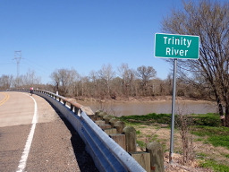 Huntsville to Crockett
- Distance
- 85.4 km
- Ascent
- 453 m
- Descent
- 499 m
- Location
- Huntsville, Texas, United States
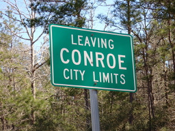 Conroe to Huntsville
- Distance
- 71.6 km
- Ascent
- 540 m
- Descent
- 441 m
- Location
- Conroe, Texas, United States
 Coronado - Tidelands Park to Novo Brazil Brewing
- Distance
- 35.4 km
- Ascent
- 16 m
- Descent
- 12 m
 Fremont - Kenmore - Kirkland - 520 - Fremont Loop
- Distance
- 49.1 km
- Ascent
- 568 m
- Descent
- 568 m
- Location
- Seattle, Washington, United States
 Ruta L-751, Retiro a Ruta L-751, Retiro
- Distance
- 75.2 km
- Ascent
- 1,070 m
- Descent
- 1,072 m
- Location
- Parral, Maule, Chile
 a BAJO HONDO
- Distance
- 34.8 km
- Ascent
- 111 m
- Descent
- 62 m
- Location
- Bahía Blanca, Buenos Aires, Argentina
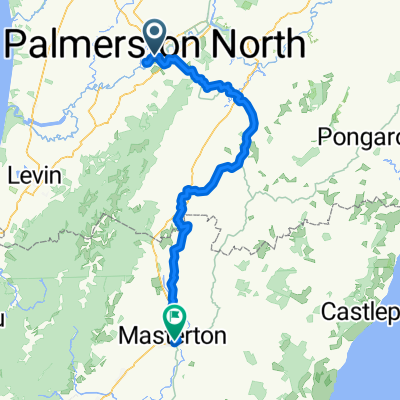 Palmerston North to Masterton
- Distance
- 117.7 km
- Ascent
- 1,514 m
- Descent
- 1,436 m
- Location
- Palmerston North, Manawatu-Wanganui, New Zealand
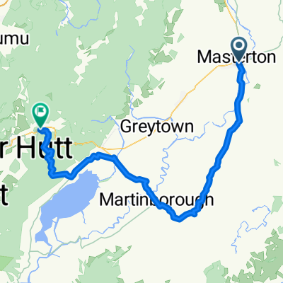 Masterton to Upper Hutt - Tour Aotearoa
- Distance
- 93 km
- Ascent
- 1,347 m
- Descent
- 1,190 m
- Location
- Masterton, Wellington Region, New Zealand
 Mooloolaba to Noosaville via Eumundi Markets, Sunrise Rd and Wust Rd and
- Distance
- 60.5 km
- Ascent
- 738 m
- Descent
- 737 m
- Location
- Mooloolabah, Queensland, Australia
 Brisbane to the Bay 2024
- Distance
- 130.5 km
- Ascent
- 1,029 m
- Descent
- 1,020 m
- Location
- South Brisbane, Queensland, Australia
 美孚新村四期商场,77 Broadway,Mei Foo Sun Chuen,香港, 香港特别行政区 to 屯马线, 香港特别行政区
- Distance
- 127.7 km
- Ascent
- 2,326 m
- Descent
- 2,330 m
- Location
- Sham Shui Po, Sham Shui Po, Hong Kong
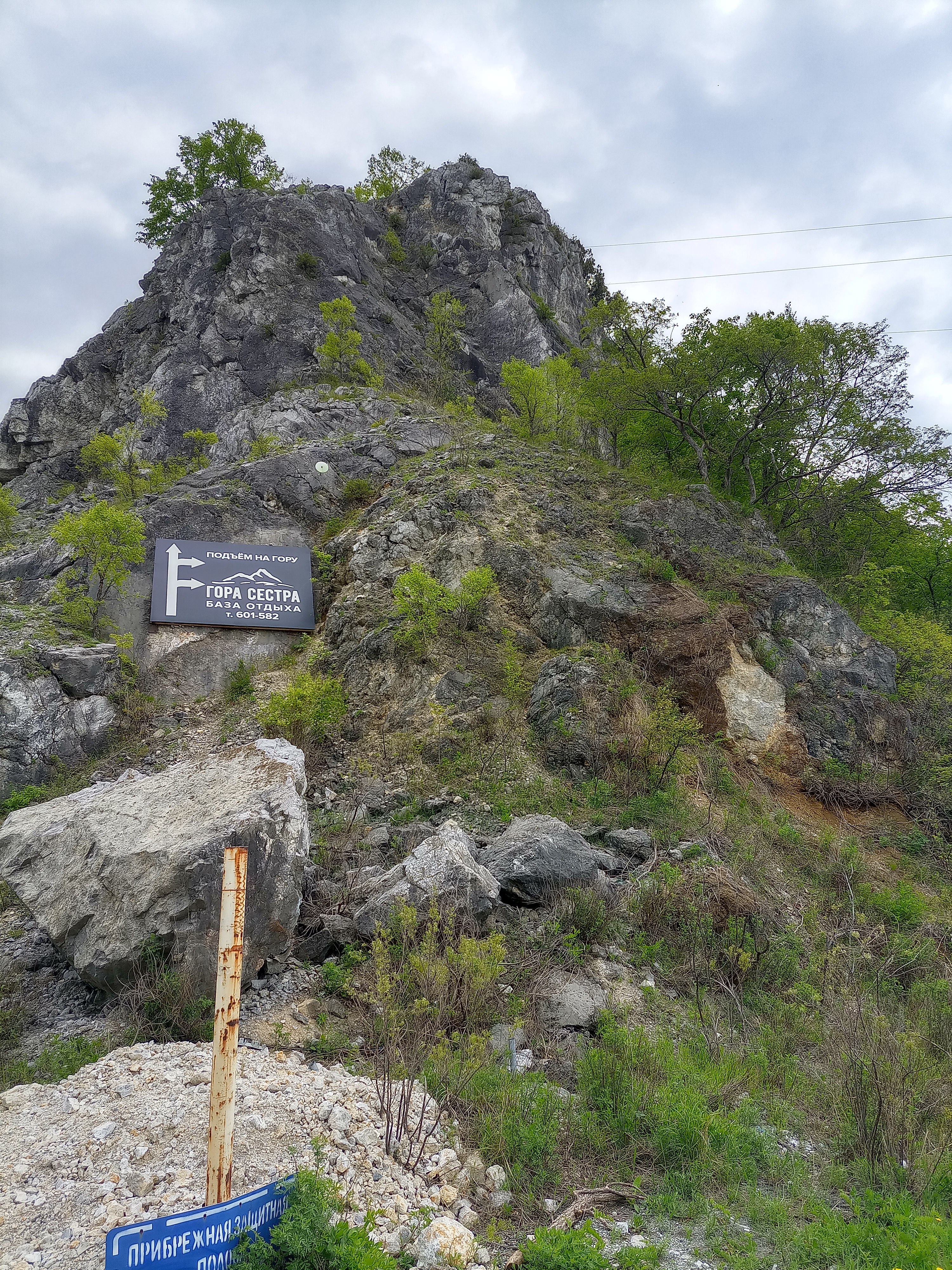 Буденовка- сопки Сестра и Брат -Буденовка
- Distance
- 35.1 km
- Ascent
- 278 m
- Descent
- 337 m
- Location
- Vladimiro-Aleksandrovskoye, Primorskiy Kray, Russia
 MP6J+R2X, Pimpri-Chinchwad to Mumbai - Pune Highway 102, Lonavala
- Distance
- 38.9 km
- Ascent
- 501 m
- Descent
- 390 m
- Location
- Dehu, Maharashtra, India
 Route to Paniyeli Poru
- Distance
- 31.8 km
- Ascent
- 429 m
- Descent
- 433 m
- Location
- Rāmamangalam, Kerala, India
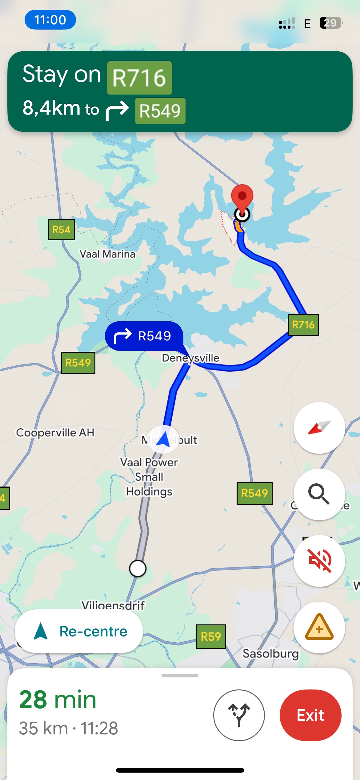 Evadne Avenue, Vereeniging to Willow Street, Deneysville
- Distance
- 31.4 km
- Ascent
- 207 m
- Descent
- 169 m
- Location
- Vanderbijlpark, Gauteng, Republic of South Africa
 home fieferana imaho espace bypass
- Distance
- 45.8 km
- Ascent
- 776 m
- Descent
- 789 m
- Location
- Antananarivo, Analamanga Region, Madagascar
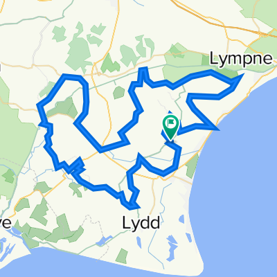 Channel 50 Challenge
- Distance
- 78.7 km
- Ascent
- 92 m
- Descent
- 96 m
- Location
- Romney Marsh, England, United Kingdom
 bfcic2021; Twickenham - Brighton 94km/57m
- Distance
- 93.9 km
- Ascent
- 615 m
- Descent
- 581 m
- Location
- Twickenham, England, United Kingdom