
Cycling in Pozuelo
Discover a map of 8 cycling routes and bike trails near Pozuelo, created by our community.
Be a pioneer
Inspire fellow cyclists with your route in Pozuelo
Bikemap is a global cycling community with millions of routes created by cyclists like you. There are only a few routes so far in Pozuelo, so plot your favourite rides on the map now to help others find the best ways to ride.
From our community
The best bike routes in and around Pozuelo

CIRCULAR LOS ANGUIJES
Cycling route in Pozuelo, Castille-La Mancha, Spain
- 44.3 km
- Distance
- 488 m
- Ascent
- 495 m
- Descent

Vta. Berro
Cycling route in Pozuelo, Castille-La Mancha, Spain
- 101.2 km
- Distance
- 1,070 m
- Ascent
- 1,063 m
- Descent

Vta. al Berro
Cycling route in Pozuelo, Castille-La Mancha, Spain
- 103.9 km
- Distance
- 1,079 m
- Ascent
- 1,074 m
- Descent

los-anguijes-a-la-herrera-desde-albacete-albacete
Cycling route in Pozuelo, Castille-La Mancha, Spain
- 24 km
- Distance
- 29 m
- Ascent
- 32 m
- Descent
Discover more routes
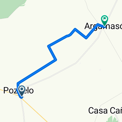 De Calle Ballesteros 5F a Calle Nueva
- Distance
- 10.9 km
- Ascent
- 9 m
- Descent
- 109 m
- Location
- Pozuelo, Castille-La Mancha, Spain
 La Solana
- Distance
- 11.5 km
- Ascent
- 146 m
- Descent
- 63 m
- Location
- Pozuelo, Castille-La Mancha, Spain
 Peñas de San Pedro
- Distance
- 16.3 km
- Ascent
- 384 m
- Descent
- 217 m
- Location
- Pozuelo, Castille-La Mancha, Spain
 fghhj
fghhj- Distance
- 118 km
- Ascent
- 1,207 m
- Descent
- 1,203 m
- Location
- Pozuelo, Castille-La Mancha, Spain