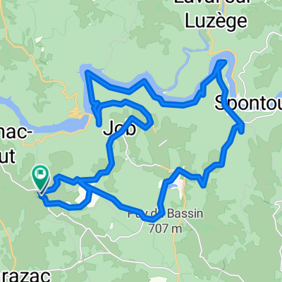
Cycling in Saint-Privat
Discover a map of 25 cycling routes and bike trails near Saint-Privat, created by our community.
Region portrait
Get to know Saint-Privat
Find the right bike route for you through Saint-Privat, where we've got 25 cycle routes to explore.
1,071 km
Tracked distance
25
Cycle routes
1,119
Population
Community
Most active users in Saint-Privat
From our community
The best bike routes in and around Saint-Privat
Ride Day 37—19 Oct 2005—19220 St-Julien-aux-Bois to 24200 Sarlat-La-Canéda
Cycling route in Saint-Privat, Aquitaine-Limousin-Poitou-Charentes, France
We spent time on outstanding country roads until hitting
populated areas along the Cère River when the land flattened and we sped along
on a relatively major road that generally had little traffic. Only in the 25 or so kilometers before
Souillac did we have to climb to a plateau where we had some rolling hills
before a long descent into Souillac. After the initial climb to the plateau where we stopped for a second
lunch, my wife decided that it was "Sarlat or bust". So, despite the relatively late hour and the 30 miles or so
to go, we hustled on and arrived in good time just before 6:30 PM. It was our highest
average speed of the trip at 10+ mph. So, as anyone will appreciate, we’re not going anywhere very fast.
Background:My wife and I have been doing self-supported tours in Western Europe (a majority in France) since 1993. This series of rides covers our 2005 2 month route through parts of France. Our beginning and ending point is near Chadurie (south of Angoulême) where our friends have a farm with Gites and Chambres d'Hotes.We rode our Dawes touring bicycles purchased in 1993 heavily loaded with 700Cx32 tires. All of our riding was on paved roads, mostly with very little traffic.If any questions, feel free to email me at jeffkadet@netdiving.comJeff
- 114.8 km
- Distance
- 633 m
- Ascent
- 1,067 m
- Descent
Ride Day 36—17 Oct 2005—19220 St-Julien-aux-Bois -- Circle
Cycling route in Saint-Privat, Aquitaine-Limousin-Poitou-Charentes, France
On this circle, we retraced part of our
2004 ride by heading east toward Salers along D37 and D35. The climb into Salers along D35 was
still just as steep as we remembered, but it was sure a lot easier without the
panniers. I was particularly proud
of my wife (1) for choosing this route for today despite her clearly remembering
this killer climb, and (2) for how she just put her head down and chugged
directly up it.
Overall, great roads. During much of the ride, we were in the Cantal Department, returning back to the Corrèze Department a little before St Julien-aux-Bois.
Background:My wife and I have been doing self-supported tours in Western Europe (a majority in France) since 1993. This series of rides covers our 2005 2 month route through parts of France. Our beginning and ending point is near Chadurie (south of Angoulême) where our friends have a farm with Gites and Chambres d'Hotes.We rode our Dawes touring bicycles purchased in 1993 heavily loaded with 700Cx32 tires. All of our riding was on paved roads, mostly with very little traffic.If any questions, feel free to email me at jeffkadet@netdiving.comJeff
- 71.6 km
- Distance
- 854 m
- Ascent
- 854 m
- Descent
Téléthon 2ème boucle
Cycling route in Saint-Privat, Aquitaine-Limousin-Poitou-Charentes, France
Auriac Dezéjouls Le Siriex Bassignac St Privat La besse Auriac (30km)
Â
Les 2 boucles 53km
- 29.5 km
- Distance
- 336 m
- Ascent
- 333 m
- Descent
Argentat Biars Camps Goulles St Cirgues St Privat Argentat
Cycling route in Saint-Privat, Aquitaine-Limousin-Poitou-Charentes, France
argentat Biars Camps Goulles St Cirgues St Privat
- 94.8 km
- Distance
- 842 m
- Ascent
- 839 m
- Descent
Discover more routes
- St Privat Pas de Peyrol St Paul Loupiac
- Distance
- 120.3 km
- Ascent
- 1,398 m
- Descent
- 1,399 m
- Location
- Saint-Privat, Aquitaine-Limousin-Poitou-Charentes, France
- Téléthon Auriac
- Distance
- 90.6 km
- Ascent
- 808 m
- Descent
- 808 m
- Location
- Saint-Privat, Aquitaine-Limousin-Poitou-Charentes, France
- Téléthon Auriac 1ère boucle
- Distance
- 23.3 km
- Ascent
- 266 m
- Descent
- 266 m
- Location
- Saint-Privat, Aquitaine-Limousin-Poitou-Charentes, France
- Grp Tour de la Xaintrie Blanche (corrèze), Saint-Geniez-ô-Merle à Soult, Saint-Geniez-ô-Merle
- Distance
- 11.8 km
- Ascent
- 482 m
- Descent
- 475 m
- Location
- Saint-Privat, Aquitaine-Limousin-Poitou-Charentes, France
- Running Bassignac
- Distance
- 5.2 km
- Ascent
- 66 m
- Descent
- 58 m
- Location
- Saint-Privat, Aquitaine-Limousin-Poitou-Charentes, France
- La Vagabonde: Saint-Privat → Beaulieu-sur-Dordogne
- Distance
- 49.1 km
- Ascent
- 931 m
- Descent
- 1,267 m
- Location
- Saint-Privat, Aquitaine-Limousin-Poitou-Charentes, France
- Viaduc Rocher noir
- Distance
- 35.1 km
- Ascent
- 535 m
- Descent
- 537 m
- Location
- Saint-Privat, Aquitaine-Limousin-Poitou-Charentes, France
- 3 Lafont, Saint-Privat Ă 1 Lafont, Saint-Privat
- Distance
- 59 km
- Ascent
- 1,525 m
- Descent
- 1,522 m
- Location
- Saint-Privat, Aquitaine-Limousin-Poitou-Charentes, France