Cycling in Le Puy-en-Velay
Discover a map of 300 cycling routes and bike trails near Le Puy-en-Velay, created by our community.
Region portrait
Get to know Le Puy-en-Velay
Find the right bike route for you through Le Puy-en-Velay, where we've got 300 cycle routes to explore. Most people get on their bikes to ride here in the months of July and August.
80,865 km
Tracked distance
300
Cycle routes
22,718
Population
Community
Most active users in Le Puy-en-Velay
Handpicked routes
Discover Le Puy-en-Velay through these collections
Tour
Tour
From our community
The best bike routes in and around Le Puy-en-Velay
Von le Puy-en-Velay - Pamblona
Cycling route in Le Puy-en-Velay, Auvergne-Rhône-Alpes, France
- 733.5 km
- Distance
- 8,996 m
- Ascent
- 9,287 m
- Descent
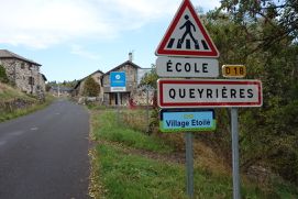
2019-18 Le-Puy-en-Velay - Circle to Queyrières
Cycling route in Le Puy-en-Velay, Auvergne-Rhône-Alpes, France
- 52.6 km
- Distance
- 682 m
- Ascent
- 681 m
- Descent
Jakobsweg Etappe 7 - Via Podensis : Le Puy - Decazeville
Cycling route in Le Puy-en-Velay, Auvergne-Rhône-Alpes, France
- 226 km
- Distance
- 2,367 m
- Ascent
- 2,802 m
- Descent
Jakobsweg Etappe 7 - Via Podensis : Le Puy - Decazeville
Cycling route in Le Puy-en-Velay, Auvergne-Rhône-Alpes, France
- 226 km
- Distance
- 2,507 m
- Ascent
- 2,943 m
- Descent
Discover more routes
 Tour 2010 (3)
- Distance
- 121.7 km
- Ascent
- 1,856 m
- Descent
- 1,600 m
- Location
- Le Puy-en-Velay, Auvergne-Rhône-Alpes, France
 Untitled route
- Distance
- 98.1 km
- Ascent
- 2,508 m
- Descent
- 2,095 m
- Location
- Le Puy-en-Velay, Auvergne-Rhône-Alpes, France
 Le Puy en Velay - Saint Jean Pied de Port
- Distance
- 715.6 km
- Ascent
- 2,295 m
- Descent
- 2,772 m
- Location
- Le Puy-en-Velay, Auvergne-Rhône-Alpes, France
 Le Puy en Velay - Capdenac
- Distance
- 238.4 km
- Ascent
- 1,827 m
- Descent
- 2,284 m
- Location
- Le Puy-en-Velay, Auvergne-Rhône-Alpes, France
 Jakobsweg 2018
- Distance
- 645.1 km
- Ascent
- 2,206 m
- Descent
- 2,674 m
- Location
- Le Puy-en-Velay, Auvergne-Rhône-Alpes, France
 Le Puy en Velay / Saint Vincent
- Distance
- 35.9 km
- Ascent
- 220 m
- Descent
- 224 m
- Location
- Le Puy-en-Velay, Auvergne-Rhône-Alpes, France
 voie verte coubon
- Distance
- 18.1 km
- Ascent
- 155 m
- Descent
- 149 m
- Location
- Le Puy-en-Velay, Auvergne-Rhône-Alpes, France
 Le-Puy-en-Velay -> Thiers
- Distance
- 129.3 km
- Ascent
- 1,257 m
- Descent
- 1,497 m
- Location
- Le Puy-en-Velay, Auvergne-Rhône-Alpes, France


