
Cycling in Madrid
Discover a map of 504 cycling routes and bike trails near Madrid, created by our community.
Region portrait
Get to know Madrid
Find the right bike route for you through Madrid, where we've got 504 cycle routes to explore. Most people get on their bikes to ride here in the months of May and June.
80,883 km
Tracked distance
504
Cycle routes
3.3 million
Population
Community
Most active users in Madrid


Handpicked routes
Discover Madrid through these collections
From our community
The best bike routes in and around Madrid

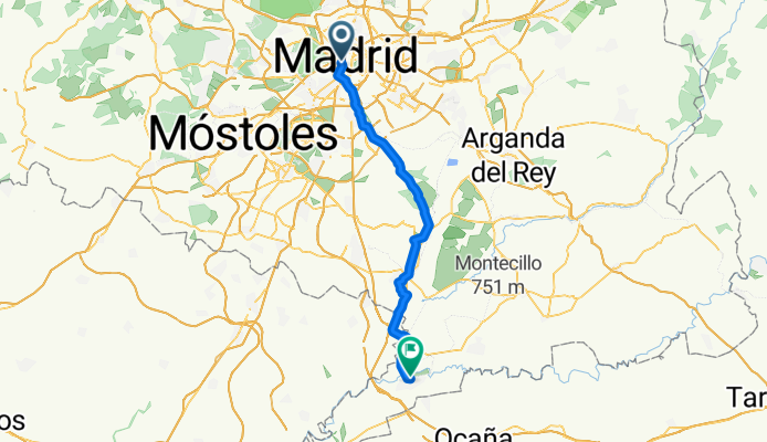
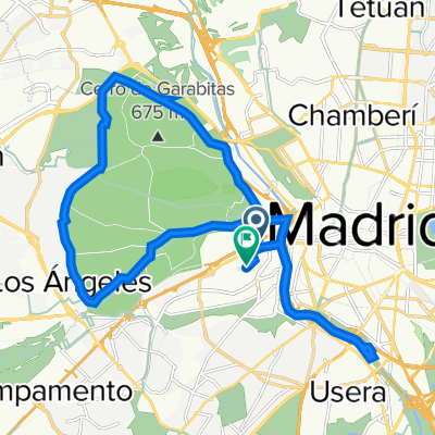
Calle del Codo, Madrid to El cocheron 1910 Calle de Montesinos, Aranjuez
Cycling route in Madrid, Madrid, Spain
- 54.8 km
- Distance
- 303 m
- Ascent
- 460 m
- Descent
From our editors
Top cycle routes in and around Madrid

Madrid Río is an attractive new park which follows the urban stretch of the Manzanares River. With lots of attractive bridges and landscaped gardens to ride across and around in, this development has added 30 km (19 miles) of accessible bike paths to the city. There are other activities you can indulge in here, too – tennis courts, soccer fields, rowing lanes, a climbing wall, a skate park and a bmx circuit. There is even an urban sand beach for a tanning siesta. We can't think of a better way of repurposing land recently won from moving a city highway underground.
Featured routes around Madrid Río Park
- Manzanares - Casa de Campo - Manzanares


- Distance
- 21.5 km
- Ascent
- 174 m
- Descent
- 162 m
- Location
- Usera, Madrid, Spain
- Tres Aguas - Madrid Rio - Tres Aguas

- Distance
- 39.9 km
- Ascent
- 172 m
- Descent
- 173 m
- Location
- Alcorcón, Madrid, Spain
- Madrid RIO - Lago Casa de Campo


- Distance
- 13.9 km
- Ascent
- 64 m
- Descent
- 64 m
- Location
- Arganzuela, Madrid, Spain
- Pau Vallecas-Madrid Rio


- Distance
- 36.7 km
- Ascent
- 191 m
- Descent
- 191 m
- Location
- Villa de Vallecas, Madrid, Spain
- Ruta Pulsaciones Zona 2 (Madrid Rio CDC)

- Distance
- 33.6 km
- Ascent
- 178 m
- Descent
- 178 m
- Location
- Madrid City Center, Madrid, Spain


Madrid Río is also a useful starting point for longer cycle routes. Escape the city center by continuing on to the Anillo Verde, a green belt around the capital which is open to cyclists. Another cool route you can take from Madrid Río park takes you through Parque Tierno Galván and Parque Lineal Manzanares Sur, and from here all the way to the city of Getafe, just south of Madrid. The north end of the park connects to a cycle path which leads all the way to the town of Manzanares El Real in the mountains. Here, make sure you visit La Pedriza, a natural landscape characterized by expressive rock formations and caves.
Featured routes beyond the city borders
- Anillo verde - Madrid

- Distance
- 62.8 km
- Ascent
- 352 m
- Descent
- 352 m
- Location
- San Blas-Canillejas, Madrid, Spain
- Madrid - Majadahonda - Villanueva de la Cañada - Quijorna - Navalagamella - Fresnedillas de la Oliva - Robledo de Chavela - El Escorial - Guadarrama - Villalba

- Distance
- 152.2 km
- Ascent
- 1,069 m
- Descent
- 1,069 m
- Location
- Carabanchel, Madrid, Spain
- Getafe - Cortados de Rivas - Getafe

- Distance
- 46.2 km
- Ascent
- 164 m
- Descent
- 161 m
- Location
- Getafe, Madrid, Spain


Casa de Campo is an amazing urban cycling destination, as the park is situated so close to the center of Madrid. The former royal hunting grounds extend to over 1750 hectares (6.8 sq mi) of forested, hilly terrain. This is so much more than a park: there is even a cable car which comfortably takes visitors to a lookout point over Madrid, as well as some challenging mountainbiking and hiking trails. They can get quite busy, so it's probably best to get some training in early in the day. But with a bull ranch, a lake and a zoo to visit, it is easy to spend a whole day here.
Featured routes around Casa de Campo
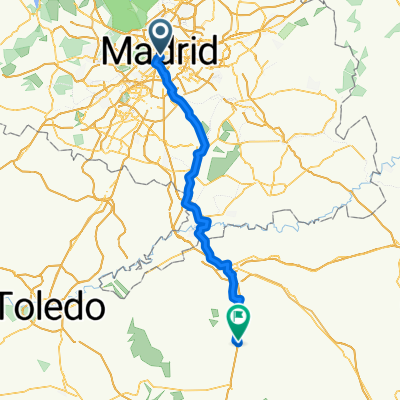
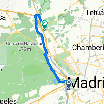
- Casa de Campo - Centro - Madrid Río.


- Distance
- 25.7 km
- Ascent
- 273 m
- Descent
- 273 m
- Location
- Latina, Madrid, Spain


The intrepid cyclist won't let a lack of perfect cycle infrastructure get in the way of sightseeing! Plaza de España with its impressive Cervantes monument and prominent skyscrapers is a good place to start. Take in the nearby Royal Palace and don't miss Plaza Mayor, the fanciest square in Madrid with its frescoes and wrought-iron balconies. Row a boat in Retiro Park, walk through seven centuries of European art at the Museo del Prado, and spend a Sunday morning shopping at El Rastro market. Top it all off with sangria and tapas at Plaza Santa Ana – but if you're going to do as the Spanish do, don't think of getting dinner before 10pm.
Featured routes in the city center


Discover more routes
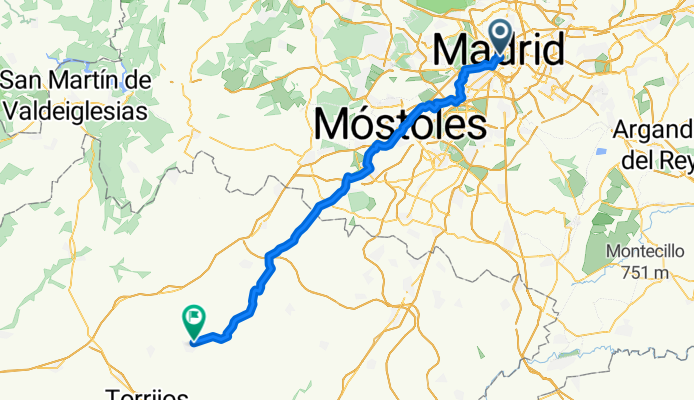
 Madrid - La Guardia
- Distance
- 97.9 km
- Ascent
- 803 m
- Descent
- 782 m
- Location
- Madrid, Madrid, Spain
 Calle de Cobos de Segovia, Madrid a Paseo Melancolicos, Madrid
- Distance
- 22.5 km
- Ascent
- 69 m
- Descent
- 67 m
- Location
- Madrid, Madrid, Spain
 madrid valencia
- Distance
- 395.9 km
- Ascent
- 1,570 m
- Descent
- 2,208 m
- Location
- Madrid, Madrid, Spain
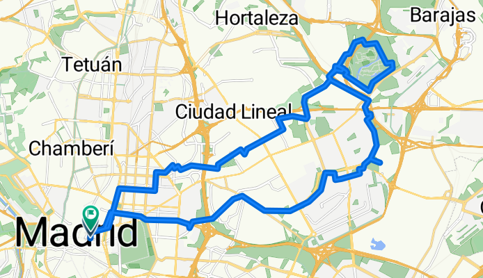
 River and gardens route
- Distance
- 13.3 km
- Ascent
- 99 m
- Descent
- 94 m
- Location
- Madrid, Madrid, Spain
 Paseo de Extremadura, 41–53, Madrid a Calle de Pericles, 28, Madrid
- Distance
- 25.7 km
- Ascent
- 647 m
- Descent
- 640 m
- Location
- Madrid, Madrid, Spain
 facultad de veterinario
- Distance
- 8.8 km
- Ascent
- 42 m
- Descent
- 35 m
- Location
- Madrid, Madrid, Spain
 Experimento_Oeste
- Distance
- 144.9 km
- Ascent
- 1,409 m
- Descent
- 1,409 m
- Location
- Madrid, Madrid, Spain
 Madrid-Lisboa-Compostela
- Distance
- 1,252.1 km
- Ascent
- 1,292 m
- Descent
- 1,693 m
- Location
- Madrid, Madrid, Spain