
Cycling in San Felipe Orizatlán
Discover a map of 9 cycling routes and bike trails near San Felipe Orizatlán, created by our community.
Be a pioneer
Inspire fellow cyclists with your route in San Felipe Orizatlán
Bikemap is a global cycling community with millions of routes created by cyclists like you. There are only a few routes so far in San Felipe Orizatlán, so plot your favourite rides on the map now to help others find the best ways to ride.
From our community
The best bike routes in and around San Felipe Orizatlán
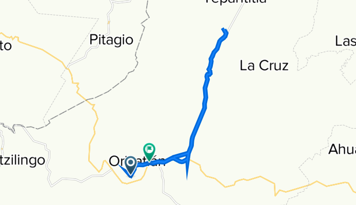
De Avenida 20 de Noviembre, San Felipe Orizatlán a Carretera Tamazunchale-Huejulta de Reyes, San Felipe Orizatlán
Cycling route in San Felipe Orizatlán, Hidalgo, Mexico
- 14.7 km
- Distance
- 180 m
- Ascent
- 187 m
- Descent

Recovered Route
Cycling route in San Felipe Orizatlán, Hidalgo, Mexico
- 7.2 km
- Distance
- 53 m
- Ascent
- 42 m
- Descent

Recovered Route
Cycling route in San Felipe Orizatlán, Hidalgo, Mexico
- 10.2 km
- Distance
- 106 m
- Ascent
- 110 m
- Descent

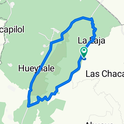
Corta La Laja
Cycling route in San Felipe Orizatlán, Hidalgo, Mexico
- 3.3 km
- Distance
- 116 m
- Ascent
- 115 m
- Descent
Discover more routes
 Xochi-Chacas-Carrizal-Xochi
- Distance
- 8.9 km
- Ascent
- 297 m
- Descent
- 289 m
- Location
- San Felipe Orizatlán, Hidalgo, Mexico
 Xochi-Naranjal-Sabinos-Xochi
- Distance
- 22.3 km
- Ascent
- 1,020 m
- Descent
- 1,021 m
- Location
- San Felipe Orizatlán, Hidalgo, Mexico
 HUEJUTLA
- Distance
- 25.1 km
- Ascent
- 423 m
- Descent
- 448 m
- Location
- San Felipe Orizatlán, Hidalgo, Mexico
 Recovered Route
- Distance
- 4 km
- Ascent
- 128 m
- Descent
- 3 m
- Location
- San Felipe Orizatlán, Hidalgo, Mexico
 Recovered Route
- Distance
- 4.1 km
- Ascent
- 16 m
- Descent
- 42 m
- Location
- San Felipe Orizatlán, Hidalgo, Mexico