
Cycling in Booneville
Discover a map of 4 cycling routes and bike trails near Booneville, created by our community.
Be a pioneer
Inspire fellow cyclists with your route in Booneville
Bikemap is a global cycling community with millions of routes created by cyclists like you. There are only a few routes so far in Booneville, so plot your favourite rides on the map now to help others find the best ways to ride.
From our community
The best bike routes in and around Booneville

DAY 15 Booneville -
Cycling route in Booneville, Kentucky, United States
Hwy 28 - Hwy 15= 36miles
- 180.5 km
- Distance
- 981 m
- Ascent
- 946 m
- Descent
Mulberry Street 64, Beattyville to mini mall drive 226, Berea
Cycling route in Booneville, Kentucky, United States
- 76.9 km
- Distance
- 1,364 m
- Ascent
- 1,266 m
- Descent

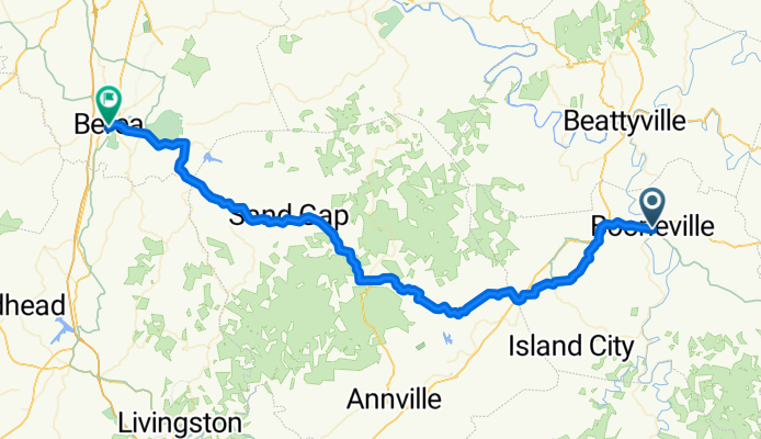
KY-11, Booneville to 301 Chestnut St, Berea
Cycling route in Booneville, Kentucky, United States
- 78.7 km
- Distance
- 1,257 m
- Ascent
- 1,159 m
- Descent

76 Booneville to Hazard (Kentucky)
Cycling route in Booneville, Kentucky, United States
Roll from Booneville on the South Fork Kentucky River to Hazard, a small mountain city in eastern Kentucky. About 76 km with roughly 2,200 m of climbing—expect punchy hills and winding creek valleys. It’s mostly on busy roads, so plan for traffic and variable shoulders; lights and a mirror help. Services are sparse between towns, so stock up early. Finish in Hazard with plenty of spots to refuel.
- 76.4 km
- Distance
- 2,192 m
- Ascent
- 2,204 m
- Descent